
| دول الشمال: الدنمارك, فنلندا, أيسلندا, النرويج, السويد الفايكنج والنورس القديم • تاريخ • ثقافة سامي • شتاء • حق الوصول • القوارب • التنزه • أطباق • موسيقى • نورديك نوير |
في ال دول الشمال من فنلندا, أيسلندا, النرويج و السويد هناك مناطق كبيرة ذات كثافة سكانية منخفضة مناسبة لها حقائب الظهر البرية والمشي لمسافات طويلة من نزل إلى نزل لعدة أيام ، ومناطق للتنزه النهاري حتى بالقرب من معظم البلدات والقرى - في النرويج بما في ذلك المشي لمسافات طويلة إلى قمم عالية. هناك مجموعة متنوعة غنية من المناظر الطبيعية في بلدان الشمال الأوروبي ، من أيسلندا البركانية إلى الغابات الشرقية في فنلندا ، ومن جبال الألب في النرويج إلى الأراضي المنخفضة اللطيفة في الدنمارك وجنوب السويد. ال حرية التجوال، وتسمى أيضا الحق في الوصول أو باللغة السويدية / النرويجية allemansrätten / allemannsretten ("حقوق كل رجل") ، يتيح لأي شخص الوصول إلى معظم الطبيعة.
في الشتاء الذي قد يعني من يناير إلى فبراير أو من أكتوبر إلى مايو ، حسب الوجهة ، التزلج عبر البلاد هو السبيل للذهاب ، على الأقل لمسافات أطول في العديد من المناطق - تعتبر حقائب الظهر والتزلج في الريف إلى حد ما نفس النشاط. في الوجهات ذات مسارات المشي ، غالبًا ما توجد مسارات تزلج في الشتاء.
بعض النصائح أدناه ذات صلة أيضًا بطرق أخرى لاستكشاف المناظر الطبيعية.
ل جزر فايرو, الأرض الخضراء و سفالبارد، راجع مقالاتهم الرئيسية.
في حين أن المناطق البرية في الدنمارك صغيرة جدًا مقارنة ببلدان الشمال الأوروبي الأخرى ، لا يزال لدى الدولة بعض الفرص للحياة في الهواء الطلق. يرى التخييم البدائي في الدنمارك.
| كوفيد -19 معلومة: لم يعد مسموحًا بالوصول إلى كوخ برية نرويجي بدون حجز. في فنلندا ، تم إغلاق المرافق في ربيع عام 2020 ، ولكن أعيد فتحها ، ويطلب من الزوار فقط تجنب أماكن الراحة المزدحمة واتباع التوصيات بعناية بشأن النظافة والمسافات وما إلى ذلك. لا يتم توفير الصابون والمطهرات ، لذلك يجب حملها بأنفسكم. | |
| (آخر تحديث للمعلومات في 2 فبراير 2021) |
تفهم

| “ | محتاج إلى نار أتى الآن. مخدر بالبرد في الركبة. الطعام والملابس التي يتوق إليها الرحالة الذي نجح على حافة الريم. | ” |
هافامال | ||
تغطي النرويج والسويد وفنلندا معًا مساحة تزيد عن مليون كيلومتر مربع ، أي عشرة أضعاف مساحة النمسا وسويسرا مجتمعين. تشمل منطقة المشي لمسافات طويلة المضايق والسواحل الأطلسية المعتدلة الرطبة للنرويج ، عبر قمم جبال الألب البرية المرتفعة للجبال الاسكندنافية ، إلى الهضاب الواسعة والغابات العميقة في الداخل.
منذ بضعة أجيال فقط ، كان معظم الناس في بلدان الشمال الأوروبي يعيشون في الريف. مع قلة عدد السكان وحقولهم الشحيحة ، أعطت الغابات وصيد الأسماك وقطف التوت دخلاً تكميليًا مهمًا للكثيرين. اليوم ، تعد رياضة المشي لمسافات طويلة وصيد الأسماك وقطف التوت أجزاء أساسية من الإجازات للعديد من السكان المحليين ، في الغالب للتسلية في الكوخ الصيفي. ليس كل شخص متجولًا جادًا في المناطق النائية - ولكن هناك عدد غير قليل.
يعتبر الصيد أحد جوانب تقاليد الشمال في الهواء الطلق ، وهو أمر غريب بالنسبة للكثيرين من البلدان حيث كان هذا شيئًا مخصصًا لمالكي الأراضي ، والطبقة العليا. في البلدان الاسكندنافية ، كانت الغابات دائمًا إلى حد كبير مملوكة للمزارعين ، وكان هؤلاء يمارسون الصيد كمصدر تكميلي مهم في بعض الأحيان للغذاء. من الطبيعي أن تكون جزءًا من نادي الصيد المحلي في الريف. الكلمة الفنلندية التي تعني البرية ، erämaa، يعني أيضًا مناطق الصيد وصيد الأسماك. في الأزمنة القديمة ، كان الناس يذهبون في رحلات على وجه التحديد للحصول على الطعام والفراء ، وكان المشي لمسافات طويلة يتضمن آثارًا لهذا التقليد ، على الأقل بالنسبة لبعض المتنزهين.
حتى المناطق النائية نادرا ما تمس. في الشمال ، تستخدم معظم المناطق لتربية الرنة. تستخدم معظم الغابات غير المحمية في الغابات. في الممارسة العملية ، سوف يلاحظ معظم الناس هذا فقط من حين لآخر.
نظرًا لقلة عدد السكان ، خاصة في الشمال ، ستكون الممرات هادئة تمامًا ، بخلاف قرب المنتجعات السياحية الرئيسية. الممرات الخارجية سترى قلة من الناس حتى بالقرب من المدن. بالقرب من الطرق الرئيسية قد تسمع حركة المرور ، ولكن في المناطق ذات الكثافة السكانية المنخفضة سوف تسمع قريبًا الصمت فقط.
المناخ والتضاريس

يختلف نوع التضاريس والظروف الجوية بشكل كبير ، من جبال النرويج شديدة الانحدار إلى سهول أوستروبوثنيا الفنلندية شبه المسطحة ، ومن المناخ المعتدل والممطر لساحل المحيط الأطلسي إلى المناخ القاري تقريبًا في فنلندا الداخلية ومن المناخ المعتدل الدافئ في الجنوب إلى الأنهار الجليدية في الجبال والتندرا في أقصى الشمال.
تم تطوير أقل من 5٪ من مساحة أراضي النرويج (أراضي زراعية ، طرق ، مدن) ، والنسبة متشابهة في البلدان الأخرى. في النرويج ، حوالي 50٪ من المساحة عبارة عن مساحة مفتوحة بدون غابات ، بما في ذلك الأرض الصلبة الخالية من الأشجار والصخور العارية ، وأكثر من 30٪ عبارة عن غابات وحوالي 5٪ أراضي رطبة ومستنقعات (خاصة في شرق النرويج وترونديلاغ وفينمارك) ، 5٪ مياه عذبة (أنهار وبحيرات) و 1٪ جليد أو ثلج دائم. في فنلندا ، 70٪ عبارة عن غابات ، في حين أن المساحة المفتوحة تتكون في الغالب من بحيرات ومستنقعات ، في أقصى الشمال أيضًا مناطق استوائية كبيرة. كما تنتشر الأراضي الرطبة في السويد (حوالي 20٪ من المساحة). حوالي 63٪ من أيسلندا قاحلة ، 23٪ بها نباتات من نوع ما ، 12٪ مغطاة بالأنهار الجليدية و 3٪ بحيرات.
خدمات التنبؤ بالطقس ذات نوعية جيدة بشكل عام ، ولكن قد تكون هناك حاجة إلى خبرة محلية لتفسيرها: تختلف ظروف الرياح اعتمادًا على الطوبولوجيا المحلية وبالنسبة لدرجة الحرارة ، يتم إخبار متوسط الحد الأقصى اليومي فقط في العديد من التنبؤات ، ويجب استنتاج التباين ودرجات الحرارة الليلية. تكون الرياح بشكل عام أقوى في الجبال العالية والجرداء وعلى طول الساحل الخارجي. عادة ما يكون الفرق بين درجة الحرارة القصوى والدنيا في يوم معين في النطاق 3-15 درجة مئوية (5-30 درجة فهرنهايت) ، ما لم تكن هناك تغيرات كبيرة في الطقس. عادة ما تعني السماء الصافية ليلة باردة. يتراوح متوسط درجات الحرارة القصوى في النهار في يوليو من حوالي 15 درجة مئوية (60 درجة فهرنهايت) إلى حوالي 23 درجة مئوية (75 درجة فهرنهايت) اعتمادًا على الموقع ، في يناير من حوالي التجمد إلى حوالي -10 درجة مئوية (15 درجة فهرنهايت) ، الجبال العالية غير محسوب. يمكن أن تختلف درجات الحرارة القصوى من 35 درجة مئوية (95 درجة فهرنهايت) في الصيف إلى -50 درجة مئوية (-55 درجة فهرنهايت) في الشتاء الداخلي الشمالي.
تتوفر خدمات التنبؤ بالطقس والمعلومات حول المناخ لفنلندا من معهد الأرصاد الجوية (الهواتف الذكية) أو Foreca، للنرويج من مكتب الأرصاد وأخبار الطقس وأيسلندا من مكتب الأرصاد الجوية الآيسلندي.
تقع المنطقة في المنطقة الحدودية بين الغرب والقطب الجنوبي. يمكن أن يسيطر نظام طقس معين على الطقس أو قد يكون من الصعب التنبؤ بالطقس المتناوب. بالقرب من ساحل المحيط الأطلسي (أي في آيسلندا وفي النرويج وبالقرب منها) وعلى ارتفاعات عالية ، من الشائع حدوث تغيرات سريعة في الطقس.

يصعب زيارة الجبال العالية والأنهار الجليدية في بعض أوقات السنة. عند الحكم على الارتفاع ، تذكر أن خط الأشجار يمكن أن يكون أقل من 400 متر في أقصى شمال فنلندا والنرويج. في الجبال العالية في النرويج وأيسلندا يمكن أن يبقى الثلج بعد الشتاء حتى يونيو ، ويمكن أن تبقى بقع كبيرة طوال الصيف. سيرًا على الأقدام ، يمكن زيارة الجبال المرتفعة في النرويج في النصف الثاني فقط من الصيف وأوائل الخريف (عادةً من يوليو إلى سبتمبر ، يجب أن يحصل الزوار على معلومات محددة لكل منطقة).
غالبًا ما يكون السطح في الجبال العالية وعرة جدًا ، وغالبًا ما تكون صخورًا فضفاضة ، وصخورًا وثلجًا وأنهارًا جليدية - وعادة ما يكون المشي لمسافات طويلة شاقًا ويلزم أحذية جيدة. يظهر هذا السطح القاحل الوعرة على ارتفاع أقل بكثير في النرويج مما هو عليه في أوروبا القارية أو في جبال روكي الأمريكية ؛ حتى على ارتفاع 1000 إلى 1500 متر فوق مستوى سطح البحر ، هناك ظروف جبال الألب المرتفعة مع عدم وجود أي نباتات وحقول ثلجية متبقية خلال الصيف.

على ارتفاعات منخفضة ، ولكن فوق خط الشجرة ، غالبًا ما يكون هناك من السهل السير على الأقدام. هذه هي التضاريس النموذجية في "المنحدرات المنخفضة" (lågfjäll) ، كما هو الحال في أقصى شمال فنلندا وبين الجبال العالية والغابات في السويد. غالبًا ما تكون التضاريس الرطبة بالقرب من خط الأشجار مغطاة بكثافة بالصفصاف (ساليكس) الشجيرات ، مرهقة للغاية للوصول إليها. غالبًا ما تكون الوديان غابات ، في المقام الأول من خشب البتولا ، ولكن أيضًا في بعض المناطق مع الصنوبر وقليل من غابات الصنوبر والتنوب.
غابات الصنوبر والتنوب هي الجزء الغربي من حزام التايغا العظيم في شمال أوراسيا. يغطي حزام التايغا معظم فنلندا والسويد وأجزاء من النرويج (خاصة شرق النرويج وبعض المناطق الحدودية). في الأراضي المنخفضة ، وخاصة في بعض أجزاء من فنلندا والسويد ، توجد أيضًا مستنقعات شاسعة ومستنقعات. غادر العصر الجليدي إسكير ، مما أعطى المناظر الطبيعية طابعًا غريبًا متداولًا في بعض المناطق. كان جزء كبير من جنوب فنلندا والسويد تحت مستوى سطح البحر عندما غادر الجليد ، وغالبًا ما يكون حجر الأساس مرئيًا حتى على التلال المنخفضة ، حيث تنمو الأشجار حيث تراكمت كمية كافية من التربة ، مما أدى إلى غابة متفرقة على قمم التلال. باستثناء بعض المناطق ، جزء صغير فقط من الأرض هو الأراضي الزراعية. تهيمن الغابات ، على الرغم من أن الكثير منها يستخدم في الغابات ، مع العديد من عمليات التطهير. توجد الغابة القديمة هنا وهناك ، تم إنقاذها من خلال التضاريس الصعبة ، ومساحات أكبر بعيدة بما يكفي عن الطرق والأنهار.
الارتفاعات والتضاريس


تقع أعلى الارتفاعات في الأجزاء الغربية من شبه الجزيرة الاسكندنافية من أقصى جنوب النرويج ، عبر وسط النرويج والمناطق الحدودية مع السويد وحتى ترومس و فينمارك المقاطعات في أقصى الشمال. غالبًا ما يشار إلى هذه المرتفعات باسم الجبال الاسكندنافية. أعلى القمم في النرويج جوتنهايمينحيث أعلى قمة 2469 م. يبلغ ارتفاع حوالي 200 قمة في النرويج فوق 2000 متر - معظمها في جوتنهايمين ولكن أيضًا في روندان و دوفريفيجيل. أعلى قمم السويد في لابلاند بالقرب من الحدود مع النرويج ، مع وجود عدد قليل من القمم فوق 2000 متر. أعلى قمم آيسلندا في داخل أيسلندا و جنوب ايسلندا، مع ذروة واحدة فوق 2000 متر. تقتصر الأراضي المنخفضة في النرويج إلى حد كبير على الوديان والشواطئ. بشكل عام ، تعني الارتفاعات العالية أيضًا التضاريس الأكثر وحشية ، لا سيما على طول ساحل المحيط الأطلسي في النرويج مع المضايق الهائلة (مثل سوجنيفجورد) وقمم شاهقة ترتفع مباشرة من المحيط مثل في لوفوتين. ومع ذلك ، توجد بعض الارتفاعات العالية ذات التضاريس الأكثر رقة (الهضاب العالية) ، مثل هاردانجيرفيدا هضبة، دوفريفيجيل، امتدادات طويلة من المرتفعات بين الوديان العظيمة لشرق النرويج ، وفينماركسفيدا (الداخلية فينمارك هضبة). بسبب المناخ الأكثر برودة في أقصى الشمال ، فإن فينماركسفيدا ومرتفعات أخرى في فينمارك قاحلة إلى حد ما حتى على ارتفاع 300 إلى 500 متر فوق مستوى سطح البحر.
على عكس القسم الغربي ، فنلندا تتميز بشكل أكبر بتضاريس لطيفة مع غابات أو نطاقات مفتوحة. تبلغ أعلى ارتفاعات فنلندا حوالي 1300 متر فقط ، ولا يمكن العثور على الجبال التي يزيد ارتفاعها عن 1000 متر فوق مستوى سطح البحر إلا في "ذراع" فنلندا في أقصى الشمال الغربي. باستثناء بعض الاستثناءات في الشرق ، نادرًا ما تصادف جبالًا يزيد ارتفاعها عن 300 متر جنوبًا لابلاند. من ناحية أخرى ، تغطي البحيرات والجداول جزءًا كبيرًا من فنلندا.
مقارنة بفنلندا ، السويد هي جبلية ومعظم ما يقع شمال خط ستوكهولم - أوسلو عبارة عن برية حرجية بدون أي مدن رئيسية. أخيرا سكانيا، الجزء الجنوبي من السويد ، يذكر بالدنمارك أو هولندا أو شمال ألمانيا - فهو مسطح بشكل أساسي مثل فطيرة ، وجزء كبير منه أراضي زراعية.
آيسلندا قاحلة بالمثل مثل النرويج. تقع أعلى ارتفاعات آيسلندا في المناطق الداخلية لأيسلندا وفي سلسلة جبال Tröllaskagi في شمال أيسلندا. في أماكن أخرى من أيسلندا ، تقل الارتفاعات عن 600 متر.
الجبال

في النرويجية ، يشير مصطلح "الجبل" ("fjell") في الغالب إلى الارتفاعات التي تتجاوز خط الشجرة. غالبًا ما تسمى الهضاب الأقل حدة ، والمستوية نسبيًا ، والتي لا تحتوي على أشجار بدون قمم واضحة "vidde" (القائمة أدناه تتضمن جزئيًا هضاب مثل Finnmarksvidda الواسعة في الشمال).
يمكن تقسيم الجبال الاسكندنافية تقريبًا كما في الخريطة.
- A & B: جبال القطب الشمالي
- بما في ذلك Kebnekaise ، منتزه سارك الوطني, لينجن جبال الألب لوفوتين، نهر سفارتيسن الجليدي ، نارفيك, منطقة Käsivarsi البرية
- C: المرتفعات الحدودية الوسطى (النرويج والسويد)
- D: نطاق المضايق
- بما في ذلك Sunnmøre & رومسدال جبال الألب جوستيدالسبرين الجليدية ، معظم سوجنيفجوردين
- إنتربرايز: الجبال الوسطى
- بما فيها روندان-دوفريفيجيل, جوتنهايمين (الأعلى في شمال أوروبا)
- F: المرتفعات الجنوبية
- بما فيها هاردانجيرفيدا الهضبة و روجالاند/سيتسدال المستنقعات
مواسم
يمتد موسم التنزه في الصيف بشكل عام من منتصف مايو إلى أوائل سبتمبر ، ما عدا في الشمال وفي الجبال العالية ، حيث يبدأ في يونيو ، حتى في يوليو في بعض المناطق. المشي لمسافات طويلة سهل في الغالب في هذه الأوقات وهناك حاجة أقل للاستعدادات والمهارات والمعدات مقارنة بأجزاء أخرى من العام - لكن بعض الوجهات لا تزال تتطلب الكثير. تشكل معظم البعوض والبراغيش في الصيف مصدر إزعاج في العديد من المناطق ، خاصةً تحت خط الأشجار في الشمال من أواخر يونيو إلى أغسطس. في ليالي آب (أغسطس) ، يحل الظلام ، ويعود الأطفال إلى المدرسة وتغلق بعض المرافق السياحية أبوابها في الشتاء.
أوائل الخريف (معظمها سبتمبر) هو وقت روسكا، عندما تتحول الأوراق إلى اللون الأحمر والأصفر ، مشهد جميل بشكل خاص في لابلاند و فينمارك (لكن الفترة غالبًا ما تكون قصيرة هناك - يمكن أن يأتي الشتاء مبكرًا). يخرج العديد من السكان المحليين لقطف الفطر والعنب البري. غالبًا ما يكون هذا موسمًا لطيفًا للمشي لمسافات طويلة ؛ تكون الأيام معتدلة بشكل عام ، على الرغم من أن الصقيع قد يظهر في الليل وقد تظهر أول تساقط للثلوج في وقت متأخر من الشهر. اختفت الحشرات إلى حد كبير وأصبح الهواء هشًا في العادة. من ناحية أخرى ، فإن أواخر الخريف (أكتوبر - نوفمبر) ليس هو أفضل موسم لمعظم الزوار: فهو مظلم ورطب ، مع تساقط ثلوج غريب ولكن لا يوجد غطاء ثلجي موثوق (منتجعات التزلج تفتح ، ولكنها غالبًا ما تعتمد على الثلج الاصطناعي) . في نوفمبر ، تنخفض درجة الحرارة أحيانًا إلى -15 درجة مئوية (5 درجات فهرنهايت) أو أقل حتى في جنوب فنلندا.
في منتصف الشتاء ، لا يوجد شروق للشمس على الإطلاق في الشمال - ويمكن أن يكون هناك برودة شديدة. الأيام قصيرة أيضا في الجنوب. قد ترغب في تجربة ليلة القطب الشمالي أو عيد الميلاد في موطن الأب عيد الميلاد (يعتقد الفنلنديون أنه يعيش في لابلاند وستأتي جحافل من البريطانيين لزيارته). وإلا فقد تفضل شهر فبراير في الجنوب أو أوائل الربيع في الشمال لممارسة رياضة المشي لمسافات طويلة في فصل الشتاء. إذا كنت ستستخدم مرافق منتجع التزلج ، لاحظ قمم الإجازات الشتوية ؛ قد تحصل على صفقات ببعض الوقت. أنظر أيضا الشتاء في دول الشمال.
الربيع هو موسم محبوب للغاية من قبل العديد من السكان المحليين. الأيام نور ، والشمس قوية والطبيعة تستيقظ. يمكن أن تكون رحلات المشي في البرية متطلبة ، حيث توجد ثلوج عميقة هنا وأرض جرداء هناك ، وكثير من المياه ، ولكن العديد من الوجهات لا تمثل مشكلة. في الشمال وفي الجبال العالية ، لا يزال شهر يونيو هو وقت ذوبان الثلوج والمياه العالية في الجداول وفي الجبال العالية قد يستمر الثلج حتى شهر يوليو أو بعد ذلك. يتسبب تساقط الثلوج وارتفاع منسوب المياه في صعوبة المشي لمسافات طويلة في المناطق المتضررة في أوائل الصيف في أماكن أخرى. في وقت لاحق ، غالبًا ما يكون الثلج المتبقي مضغوطًا ، ويصعب المشي عليه.
يأتي الربيع متأخراً بشكل خاص في الجبال العالية في النرويج ، حتى في يونيو يمكن الوصول إلى بعض المناطق على الزلاجات فقط. هذا صحيح في الجبال مثل النرويجية جوتنهايمين و هاردانجيرفيدا، حيث قد يستمر تساقط الثلوج خلال شهر يونيو وقد تبقى بقع كبيرة من الثلوج حتى أواخر الصيف. حتى في فنلندا توجد مسابقة تزلج منتصف الصيف (في كيلبيسجارفي). يمارس النرويجيون رياضة المشي لمسافات طويلة سيرًا على الأقدام حاملين زلاجاتهم إلى مناطق يمكنهم فيها الاستمرار بالتزلج.
حرية التجول

الحقوق الأساسية لكل شخص (الحق في الوصول ، وحرية التجوال) هي الحق في التجول بحرية سيرًا على الأقدام أو بالتزلج أو بالقارب ، والحق في المبيت في خيمة والحق في قطف التوت والفطر الصالح للأكل. في المناطق غير البرية ، تختلف الحقوق المطبقة إلى حد ما بين البلدان - على سبيل المثال في أيسلندا ، يتطلب الدخول إلى أي منطقة مغلقة خارج الطرق إذنًا من مالك الأرض - كما هو الحال مع بعض التفاصيل. الحقوق (بشكل صحيح أكثر: عدم وجود حق مالك الأرض في الحظر) مصحوبة بتوقع أن تكون مراعًا ولا تسمح بخرق قوانين محددة ، أو إلحاق الضرر (مثل المشي في الحقول مع زراعة المحاصيل أو ترك القمامة أو فتح بوابات خلفها) أو إزعاج السكان أو الحياة البرية. بعض التفاصيل مقننة في القانون ، لكن الكثير من الأمور متروكة للتأويل ؛ قضايا المحاكم نادرة.
عند زيارة المتنزهات الوطنية والوجهات "الرسمية" الأخرى ، اقرأ التعليمات الخاصة بالمنطقة المحددة. في الغالب ، تعوض الخدمات المقدمة (مثل نيران المعسكرات ومواقع التخييم) عن القيود المحلية. يتم تشجيعك (أحيانًا مكلف) على متابعة المسارات ، حيث يتم توفيرها.
يرى حق الوصول لإجراء مناقشة أكثر شمولاً وربما روابط لأدلة لبلدان محددة.
إطلاق النار
- أنظر أيضا: المعسكر
يجب أن تكون حريصًا دائمًا عند إشعال النار - تأكد من أنك تعرف ما يعنيه ذلك. يجب دائمًا مراقبته وإخماده بعناية. على وجه الخصوص ، فإن شجرة التنوب ، المنتشرة في بلدان الشمال الأوروبي ، تخلق الكثير من المواد القابلة للاشتعال. استخدم مواقع مخصصة لإطلاق النار عند الإمكان. لا تشعل حرائق على الصخور (التي ستتصدع) أو الخث (الذي يصعب إخماده بشكل موثوق). لا تحتاج في السويد إلى إذن طالما أنك حريص. يُسمح بالنار في أيسلندا خارج المناطق المحمية حيث لا يوجد خطر نشوب حرائق غابات أو أضرار أخرى (لكن الحطب نادر). في النرويج ، يُمنع إشعال حريق بشكل عام من 15 أبريل إلى 15 سبتمبر ، إلا على مسافة آمنة سخية من الغابات والمباني وغيرها من المواد القابلة للاشتعال أو في المواقع المحددة رسميًا. يتطلب إطلاق النار في فنلندا دائمًا إذنًا من مالك الأرض ، ولكن يوجد في الشمال إذن عام لكثير من الأراضي المملوكة للدولة (تحقق من المناطق المغطاة والشروط). السماح بإشعال النار لا يعني بالضرورة الحق في أخذ الحطب ؛ لا تؤذي الأشجار أو السجلات ذات القيمة الجمالية أو البيئية. يعتبر الخشب في آيسلندا موردًا نادرًا بشكل خاص ، وما قد يعتبر غير مسموح به رسميًا ولكنه لا يسبب أي ضرر (وبالتالي مقبول) في البلدان الأخرى يمكن أن يكون سيئًا هناك بالتأكيد. في حالات الطوارئ تستخدم حكمك الخاص.
في الظروف الجافة بشكل خاص ، قد يكون هناك حظر كامل على أي نار مفتوحة في الهواء الطلق (بما في ذلك الشوايات التي تستخدم لمرة واحدة وما شابه ذلك). في فنلندا مثل هذا الحظر شائع في الصيف ، ويتم الإعلان عنه حسب المنطقة (في لابلاند: حسب البلدية) في معظم توقعات الطقس على أنه "تحذير من حرائق الغابات" (metsäpalovaroitus/فارنينغ فور skogsbrand). في الربيع ، قد يكون هناك تحذير من حرائق العشب ، وهي ليست شديدة ، لكنها لا تزال جديرة بالملاحظة. لا تعتبر مواقد التخييم نارًا مفتوحة ، لكنها غالبًا ما تكون قادرة تمامًا على إشعال حريق هائل ، لذا كن حذرًا معها (ومع المباريات المستخدمة). في السويد لا يتم الإعلان عن الحظر مركزيًا ؛ يتم اتخاذ قرار الحظر من قبل خدمات الطوارئ ، عادة على المستوى الإقليمي أو البلدي.
في المتنزهات الوطنية وما شابهها توجد مواقع لإشعال النار مع توفير الحطب مجانًا. في بعض المتنزهات الوطنية الكبيرة والمناطق البرية ، قد يُسمح بإشعال النيران حيث لا توجد مواقع لإطلاق النار في مكان قريب (راجع القواعد الخاصة بالمنطقة). لا تشعل حرائق كبيرة بشكل مفرط ، ولكن استخدم الحطب باعتدال. إذا كان بعض الحطب جاهزًا والبعض الآخر غير جاهز ، أو كان البعض في الهواء الطلق ، فيجب صنع حطب جديد ونقله إلى الداخل بدلاً من ما يتم استخدامه. عادة لا يجب تجديدها من الطبيعة. غالبًا ما يكون هناك فأس وربما منشار لهذا الغرض ، خاصة في الأماكن النائية ، ولكن قد ترغب في حملها بنفسك. السكين الجيد هو أداة البقاء الأساسية ويجب حمله في أي نزهة أطول ، كما هو الحال بالنسبة للمباريات ، بقطع غيار معبأة مقاومة للماء.

لإشعال حريق في ظروف صعبة ، عادة ما تتوفر بعض الأنواع الثلاثة من الحراق في الغابة: الأغصان الجافة الميتة منخفضة على أشجار التنوب (خذ فقط تلك التي يسهل التقاطها - يمكن أن تلتهب شجرة التنوب بسهولة) ، لحاء البتولا (لا يشبه اللحاء) من الأشجار الأخرى) أو خشب الصنوبر الراتنج. تتطلب الثلاثة تقنيات مختلفة ، لذا تدرب في مكان ما حيث لا يضر أخذ المادة ، قبل الاضطرار إلى استخدامها. باستخدام أغصان التنوب ، تحتاج إلى ما يكفي منها ، بما يكفي من المواد الدقيقة ، والتسوية الصحيحة بين الهواء الكافي والحرارة الكافية (قد تحتاج إلى استخدام يديك ؛ يجب أن تحترم النار ولكن لا تخاف). يعد استخدام لحاء البتولا أمرًا سهلاً ، لكن تحقق من سلوكه. السكين مفيد لإزالته من الخشب إلى قطع أكبر. بالنسبة للصنوبر ، المفتاح هو الحصول على شرائح جيدة بما يكفي. الصنوبر الذي يمكن استخدامه حيث يتم التعرف عليه من خلال الرائحة عند قطع طازج وبواسطة كونه ميتًا لفترة طويلة ولكنه غير فاسد ، غالبًا كأجزاء صلبة من جذع مغطى بالطحالب (درب عينك!) في غابات البتولا المتساقطة ، حيث لا يوجد خشب جاف ، يجب تقسيم خشب البتولا إلى قطع رفيعة بدرجة كافية ، وجعله رقيقًا للغاية لإشعال النار (يمكن استخدام حطب كثيف لإبقاء البعوض بعيدًا ، وبعد أن يجف كافية). يمكنك استخدام الأغصان الجافة فوق خط الأشجار ، ولكن قد يكون الحصول على كمية كافية من الحطب الجاف أمرًا صعبًا.
ضوء
نظرًا لخط العرض الشمالي ، تتجول الشمس بالقرب من الأفق ليلاً ونهارًا طوال العام. يستمر الشفق لفترة أطول بكثير من قرب خط الاستواء ، لأكثر من نصف ساعة في الجنوب وربما لعدة ساعات في ليلة القطب الشمالي (مع عدم وجود ضوء النهار).
يكون ضوء النهار محدودًا في أواخر الخريف وأوائل الشتاء ، والساعات المتاحة للمشي لمسافات طويلة محدودة للغاية على الأقل في الغابات الكثيفة ، وفي التضاريس الوعرة وحيث يصعب التوجيه ، خاصة وأن السماء غالبًا ما تكون غائمة في أواخر الخريف. في الشتاء ، سيساعد الثلج حتى النجوم على إعطاء بعض الضوء في الليل ، والذي قد يكون كافياً في التضاريس المفتوحة السهلة بمجرد أن تعتاد عليها - قد يشعر ضوء القمر بالكثير.
من مايو إلى ليالي يوليو تكون خفيفة جدًا في جميع أنحاء المنطقة. هنالك شمس منتصف الليل لمدة شهر ونصف في أقصى الشمال وبضع ساعات فقط من الظلام (النسبي) حتى في الجنوب حول منتصف الصيف. بحلول شهر أغسطس ، تصبح الليالي مظلمة وفي أواخر الخريف ، قبل أن يأتي الثلج ، تكون هناك أمسيات مظلمة طويلة جدًا.
اعلم أن أشعة الشمس يمكن أن تكون قوية للغاية في الصيف على ارتفاعات عالية بسبب الهواء النقي ، والانعكاسات من البحيرات وحقول الثلج ، وقلة الغطاء النباتي.
الناس
.jpg/220px-Amanda_Delara_(29519019388).jpg)
عادة ما يجيد الموظفون في أي مركز معلومات أو فندق وما إلى ذلك اللغة الإنجليزية بطلاقة والمعلومات التي تستهدف السائحين متاحة أيضًا باللغة الإنجليزية في الغالب. في مناطق الجذب السياحي الكبيرة والفنادق وما شابه ، عادة ما يكون هناك موظفون يجيدون عدة لغات ، ولكن في الشركات العائلية لا يتقن كبار السن بالضرورة لغتهم الأم. على الرغم من ذلك ، ستتمكن في الغالب من البقاء على قيد الحياة باللغة الإنجليزية - وقد تقابل سامي ولد في غواهتي ولكنه يتحدث عدة لغات أجنبية بطلاقة.
شمال الدول الاسكندنافية هو موطن شعب سامي؛ هم الأغلبية في عدد قليل من البلديات وأقليات كبيرة في أخرى. بسبب سياسة اللغة قبل نصف قرن ، لا يتحدث الكثير من سامي سامي، لكن الكثيرين يفعلون ذلك ، خاصة في أقصى شمال الفنلندية والسويدية لابلاند ومعظم النرويجيين فينمارك. يتحدثون أيضًا لغة الأغلبية للبلد والحدود ، وربما لغة البلد المجاور (السويدية والنرويجية مفهومة بشكل متبادل). توجد مجموعات كبيرة تتحدث اللهجات الفنلندية (Meänkieli ، Kven ؛ بالإضافة إلى لغة الأغلبية) في السويدية تورنيدالين وفي أجزاء من فينمارك.
في أرخبيل Uusimaa، الجنوبي بحر الأرخبيل, أرض وساحل أوستروبوثنيا اللغة السويدية هي اللغة التقليدية. ستعيش على اللغة الفنلندية أو الإنجليزية ، ولكن قد لا يتأثر المتحدثون باللغة السويدية كثيرًا بمحاولتك الترحيب بهم باللغة الفنلندية.
في بعض المناطق ذات الكثافة السكانية المنخفضة ، مثل لابلاند والأرخبيل الفنلندي ، تعد السياحة دخلاً تكميليًا مهمًا للكثيرين. لا تقوم الشركات العائلية الصغيرة بالضرورة بالإعلان على الإنترنت أو في الكتيبات السياحية. عليك أن تبقي عينيك مفتوحتين وتسأل محليًا.
الأماكن
- أنظر أيضا: وجهات التنزه في النرويج, المتنزهات الوطنية الفنلندية

- يحتاج الوافد الجديد إلى النار
- الذين تم تجميد ركبهم خدر.
- اللحم والكتان النظيف يحتاجه الرجل
- من نجح عبر الهضاب ... – هافامل
تسمح لك حرية التجوال بالذهاب إلى أي مكان أكثر أو أقل. توجد غابات أو أنواع أخرى من الطبيعة مفتوحة للجمهور في جميع أنحاء البلاد. أولئك الذين يحبون حقائب الظهر البرية أو يريدون البقاء بعيدًا عن الطرق لعدة أيام قد يبحثون عن المناطق الأقل اكتظاظًا بالسكان ، مثل المناطق الداخلية الشمالية لفنلندا والنرويج والسويد ، في أو شرق الجبال النرويجية الوسطى (Jotunheimen و Hardangervidda و Dovre ) ، في شرق فنلندا وداخل أيسلندا. في بعض الأماكن ، يمكنك المشي لمسافة مائة كيلومتر أكثر أو أقل في اتجاه واحد دون رؤية الطريق.
في النرويج ، توجد مسارات للمشي لمسافات طويلة أو الرحلات الطويلة في جميع أنحاء البلاد. في البلدان الأخرى ، توجد أيضًا مناطق غير مطورة في كل مكان ، ومناسبة للمشي في الغابة أو لقطف التوت ، ولكن بالنسبة للمسارات أو الطرق الأخرى المناسبة لرحلة أطول ، يتعين عليك عادةً دراسة الخريطة أكثر من ذلك بقليل ، أو السفر لمسافة معينة إلى درب مناسب.
لاحظ أن حقائب الظهر البرية في بلدان الشمال يمكن أن تعني التنزه بدون أي بنية تحتية على الإطلاق ، وربما لا تقابل أي شخص لأيام وتكون بمفردك أيضًا عندما يحدث خطأ ما. هذا شيء يأتي الكثير من الناس من أجله ، ولكن إذا كنت تشك في مهاراتك ، فاختر الطرق المناسبة. هناك جميع مستويات التنازلات المتاحة.
أفضل رياضة المشي لمسافات طويلة أو المناظر الطبيعية ليست بالضرورة في المتنزهات الوطنية أو المحميات الطبيعية. ومع ذلك ، قد يكون من المفيد أولاً التفكير في الوجهات "الرسمية" أو غير ذلك من الوجهات المعروفة جيدًا ، والتي تغطي بعضًا من أكثر الطبيعة قيمةً وبعضًا من أفضل المناظر الطبيعية. من الأسهل أيضًا العثور على معلومات وخدمات لهؤلاء.
تتداخل أحيانًا المناطق المحمية ذات الأنواع المختلفة مع بعضها البعض. قد تكون هناك ، على سبيل المثال ، مناطق ذات قيود شديدة داخل حديقة وطنية أو منطقة حدودية أقل تقييدًا خارج المتنزه. هناك أيضًا مناطق محمية لها تأثير ضئيل على المتجول ، مما يقيد بشكل أساسي تصرفات مالك الأرض وسلطات التخطيط.
في فنلندا ، يتم الحفاظ على المتنزهات الوطنية والمناطق البرية وبعض الوجهات الأخرى من قبل Metsähallitus ، إدارة الغابات الفنلندية ، والتي لديها معلومات حول الوجهات والمشي لمسافات طويلة بشكل عام Nationalparks.fi. يتم توفير المعلومات أيضًا في نقاط خدمة العملاء ومراكز زوار المنتزهات الوطنية ، حيث يمكنك حجز سرير في كوخ أو شراء تصاريح الصيد (أو حتى الصيد). أيضا المتنزهات الوطنية الفنلندية معلومات عن معظم الوجهات "الرسمية".
في النرويج جمعية الرحلات يحافظ على مسارات بين أكواخهم العديدة (النزل الجبلية) في جميع أنحاء البلاد.
المتنزهات الوطنية

في النرويج ، تشير "الحديقة الوطنية" في المقام الأول إلى الوضع المحمي للمنطقة غير المطورة. غالبًا ما تكون رياضة المشي لمسافات طويلة والمناظر الطبيعية لطيفة بنفس القدر خارج المتنزهات. غالبًا ما تكون المتنزهات الوطنية محاطة بمنطقة من "المناظر الطبيعية المحمية" ، والتي غالبًا ما تكون من وجهة نظر المتجول هي البرية الأكثر إثارة للاهتمام والأكثر سهولة في الوصول إليها.
وإلا فإن المتنزهات الوطنية هي الوجهات الأكثر وضوحًا. إنها تغطي الطبيعة التي تستحق المشاهدة بشكل خاص ، وعادة ما تكون الخدمات متاحة بسهولة ويمكن الوصول إلى معظمها دون الكثير من الجلبة. عادة ما تكون هناك مسارات أقصر بالقرب من مراكز الزوار ، وهي مناسبة لرؤية بعض الطبيعة النموذجية بسرعة ، وللرحلات اليومية وللمتنزهين الأقل خبرة. في المناطق الأكبر توجد أيضًا مناطق نائية لأولئك الذين يرغبون في السير في مساراتهم الخاصة. على عكس الممارسة في بعض البلدان الأخرى ، لا تحتوي المتنزهات الوطنية على طرق أو أسوار أو حراس - في النرويج فقط ممرات ونزل.
توجد حدائق وطنية في جميع أنحاء البلاد ، تغطي معظم أنواع المناظر الطبيعية البرية (وبعض المناظر الطبيعية المزروعة): المتنزهات الوطنية الفنلندية, الحدائق الوطنية السويدية, المتنزهات الوطنية النرويجية, المتنزهات الوطنية الآيسلندية.
غالبًا ما تقدم مراكز الزوار ("naturum" و "nasjonalparksentre") ، التي تكون أحيانًا بعيدة جدًا عن المنتزه نفسه ، مقدمة مفيدة لطبيعة وثقافة المنطقة. قد تكون هناك أفلام أو جولات إرشادية أو ما شابه ذلك ، تستحق التحقق مسبقًا. بعض المراكز مغلقة خارج الموسم أو غير مأهولة على الإطلاق.
المناطق الترفيهية
غالبًا ما يتم الوصول إلى المناطق الترفيهية بسهولة أكبر من المتنزهات الوطنية وقد يكون لها قيود أقل. العديد منها مناسب للمشي لمسافات طويلة ، على الرغم من أنها أصغر من معظم المتنزهات الوطنية ونادرًا ما تقدم أكثر المناظر الطبيعية جمالًا.
في فنلندا مناطق التنزه الوطنية تحتفظ بها Metsähallitus.
تحتوي معظم المدن على بعض المناطق الترفيهية على الأقل ، وعادة ما يمكن الوصول إليها بالحافلة المحلية أو سيرًا على الأقدام من وسط المدينة. توجد إمكانيات كبيرة للمشي لمسافات طويلة خارج بعض المدن. على سبيل المثال حول أوسلو هناك غابات واسعة مع ممرات أو مسارات جيدة الصيانة (بعضها مزود بأضواء) في متناول المترو وحافلات المدينة ، وداخل بيرغن هناك عدة جبال بجوار وسط المدينة.
توجد مسارات للمشي لمسافات طويلة والتزلج حول معظم منتجعات التزلج وما شابهها. في بعض الأحيان يتصلون بشبكات مسارات المتنزهات الوطنية.
محميات طبيعية

تتمتع المحميات الطبيعية عمومًا بأكثر أشكال الحماية صرامة ويجب التحقق مسبقًا من القواعد الخاصة بالمحمية المحددة. لقد تم إنشاؤها لحماية الطبيعة ، لذاتها ولأغراض البحث. عادة ما تكون هناك مسارات للمشي لمسافات طويلة عبر المسارات الأكبر وقد يكون هناك بعض مرافق الإقامة أو التخييم خارج المنطقة المحمية. قد تشمل طبيعة خاصة جدًا أو محفوظة جيدًا. وهي في الغالب أصغر من المتنزهات الوطنية وعادة ما تكون (تلك التي بها ممرات) مناسبة لرحلة نهارية أو نزهة ليوم واحد. غالبًا ما يُسمح بالانحراف عن المسارات في فصل الشتاء أو خارج موسم التعشيش.
مناطق برية
المناطق البرية في فنلندا هي مناطق نائية يحددها القانون ، مع قيود صارمة على البنية التحتية للبناء أو أي استغلال بخلاف الحرف التقليدية (مثل تربية الرنة أو الصيد أو أخذ الحطب للاحتياجات المنزلية). الحالة لها تأثير مباشر ضئيل على المتجول ، لكنها وجهات مثيرة للاهتمام لأولئك الذين لا يريدون مسارات جاهزة. المناطق مهمة لتربية الرنة ، قد يكون هناك صيادون ، لكن في الغالب ستكون بمفردك ، ربما لعدة أيام. توجد بعض المسارات والأكواخ البرية في المناطق وعادة ما توجد بعض الخدمات السياحية في الجوار. تتوفر عادة تراخيص صيد الطرائد الصغيرة (في الموسم). للحصول على أمثلة ، انظر Käsivarsi, Pöyrisjärvi و Muotkatunturit.
وجهات غير رسمية
يمكنك التنزه أكثر أو أقل في أي مكان تريده. السبب المعتاد لعدم استخدام وجهة "رسمية" هو أنك تريد التنزه أو التجول بالقرب من المكان الذي تقيم فيه أو تمر به. حتى بالقرب من المدن الكبرى يوجد عادة الكثير من الطبيعة البكر. غالبًا لا يميز السكان المحليون بين الوجهات "الرسمية" مثل المتنزهات الوطنية ومناطق التنزه الأخرى. تتيح لك حرية التجوال الاستمتاع بها طالما أنك تبتعد عن الساحات والأراضي المزروعة وما شابه. كن مراعًا ومهذبًا عندما تقابل أشخاصًا وحاول ألا تزعج الآخرين.
Most of the countries (about 95% of Norway) is some kind of wilderness where the public is allowed to hike. Even in such wilderness there may be occasional roads reserved for logging, hydro power construction or power line maintenance. In Finland such roads are common in unprotected areas and provide easy access for berry pickers and hikers alike, while ruining the feel of wild nature – choose routes where the forestry roads (and clearings) are not too common. In Norway there are in addition many roads to summer farms (seter) in the forests or mountains or to abandoned farms. Such roads may not be open to public traffic and are usually dead-end roads with minimal traffic. Seters are usually hubs for hiking trails in the area.
حيز المشي

Trails are often meant for use either in summer or in winter. When using them outside the intended season it is important to check the viability of the route. Winter routes are usually meant for cross-country skiing and may utilise the frozen lakes, rivers and bogs, while summer routes may have all too steep sections, go through areas dangerous in wintertime or simply be difficult to follow when marks are covered with snow. When evaluating the route, make sure you understand whether any descriptions are valid for the present conditions. Local advice is valuable.
Usually deviating from trails is allowed, except in nature reserves and restricted parts of national parks, although not encouraged in sensitive areas or areas with many visitors. Many experienced hikers prefer terrain without trails, at least for some hikes.
In addition to hiking trails at separate destinations there are some long distance hiking trails and hiking trail networks connecting nearby protected areas and recreational areas. They usually follow minor roads some or most of the distance, going through interesting natural surroundings wherever possible and sometimes passing by villages and tourist attractions, where you might be able to replenish. Lengths vary from suitable for a one day hike to the extreme European long distance paths. The longest routes are usually created by combining trails of different trail networks, which increases the risk of some parts not being well signed or maintained. There may even be parts missing. As hiking on other persons' land is perfectly allowed, you can make your own adjustments to the routes, but this may sometimes mean walking by a road or through unnecessarily difficult terrain.
On combined trails or trails that pass borders (between countries, municipalities or areas with different protection status), it is quite common that the markings or the maintenance standard change. Check that the same agent is responsible for the trail all the way or be prepared for it to change character. This is no problem if you have the equipment and skill to continue regardless, but can be problematic if you made your decision based on what the first part looked like. The character of the trail can change also for other reasons, such as leaving for the backwoods, reaching higher mountains or crossing mires.

In contrast to many trails in continental Europe, the hiking trails seldom go from village to village, but tend to mostly keep to non-inhabited areas. There is usually no transport (for instance for luggage) available. Where the trails follow traditional routes (from the time before the cars), they usually do so in the wilderness, where few villages are to be found. Newer trails have usually been made for exploring the natural landscape, not to connect settlements. Many trails lead from permanent settlements to shielings (summer farms, seter in Norwegian, fäbod in Swedish, karjamaja in Finnish) in the forest or in the high valleys, then onwards to pastures further into the uplands, high plateaus or high valleys. In Norway, such shielings are often starting points for hiking trails at higher altitudes, DNT lodges are often found at old shielings.
There are trails usable with wheelchair or prams, but this is not typical. Many trails follow quite narrow and rough paths. Even trails that start wide and smooth may have sections that are muddy (possibly with duckboards) or narrow, steep and rocky. This is true also for some very popular trails, such as the one to Trolltunga. Check, if this is important for you.
DNT maintains some 20,000 kilometres of summer trails in Norway. In the fells these are usually marked with cairns, some of which are marked with a red "T". In woods, markings are often red or blue stripes painted on trees. Winter routes and routes where the cairns would be destroyed in winter often have poles instead, also these usually with a red mark. Note that new or little used trails may be less worn than other paths leading astray. Winter routes are often marked with twigs instead of permanent marking, before the main season in spring. Markings in Finland and Sweden follow somewhat different standards.
The DNT trails are also classified: green trails do not require special skills and are often short (those suitable with wheelchair or pram are specially marked as such), blue trails require some fitness and basic skills, red trails require experience, fitness, good footwear and adequate equipment, while black trails can also be hard to navigate. Metsähallitus in Finland has some years ago started with a similar classification (with red and black combined and less emphasis on fitness, as the terrain is less demanding there).
In addition to the classification, DNT gives height profile and estimated time for the trails. The times are calculated for a fit and experienced hiker, excluding breaks – add considerable time to get a realistic estimate of total time needed.
There are three hiking routes in the Nordic countries that belong to the European long distance paths network (long sections are missing or unmarked at least in the Finnish parts):
- E1 hiking trail runs from Italy through Denmark and southern and middle Sweden to نوردكاب in Norway
- E6 hiking trail runs from Turkey through Denmark, southern Sweden and Finland to Kilpisjärvi (the north-west tip of Finland by the Swedish and Norwegian border). You can continue by the Nordkalottleden.
- E10 hiking trail runs from Spain through Germany and Finland to Nuorgam (the northern tip of Finland, by the Norwegian border). من عند Koli National Park ل Urho Kekkonen National Park in Finland the route is known as the UKK route.
ال نوردكالوتلدن/Nordkalottruta trail (800 km) goes through Sweden, Norway and Finland offering versatile northern fell landscape, with easy to travel fell highlands, lush birch forests, glaciers and steep-sided gorges.
ال بادجيلانتالدين trail (140 km) and كونغسليدن trail (440 km) meander through the national parks of Swedish Lappland, one of Europe's largest remaining wilderness areas.
Some Finnish trails are described by Metsähallitus. For trails at specific destinations, see that destination. There are also trail networks maintained or marketed by municipalities and other entities, such as the Walks in North Karelia شبكة الاتصال.
Gear

For a basic idea about what to pack, have a look at packing for a week of hiking, حقائب الظهر البرية و طقس بارد.
Good quality hiking equipment is available in many specialist shops, the largest probably being Partiovaruste / Scandinavian Outdoor Store, owned by a non-profit Finnish Girl and Boy Scout foundation. Such specialist shops should also be able to give good advice. Some equipment is available for rent at some destinations, especially if you are using a guide.
Every hiker must be familiar with the proper equipment for various seasons and areas as well as their style of hiking. In the Nordic area, choosing the right equipment may be particularly challenging outside the warmest summer and for the higher mountains.
Pack so that your spare clothes and outs won't get wet in rain and moist. Most backpacks are water repellent, but few if any are water resistant. Many have an integrated "raincoat", for others one is available as an add-on. Using plastic bags or similar inside the backpack is wise.
طوال العام
- Map – 1:50,000 standard topographical maps with trekking info are generally recommended; 1:25,000 are available for some areas and give greater detail, necessary for hikes in forests, where sight is limited; 1:75,000 and 1:100,000 are usable for good trails but may not give enough details in rough or steep terrain
- Compass – you want robust, low-tech navigation
- First aid kit
- Bottle(s) for water – e.g. used mineral water bottles
- Sunglasses – in summer, on snow and at high altitude
- Sunscreen – particularly at high altitude and where there is sun and snow
- Sleeping bag, hiking mattress and tent – on overnight hikes, unless you know you will get by without
- Food, snacks
- Camping stove – on any longer hike
- Cutlery etc.
- اعواد الكبريت
- سكين – carrying a knife in a public place is illegal, unless you have a good reason, carrying it together with camping equipment is acceptable.
- Repair kit covering any essential gear (by your definition of essential on the hike in question – knife, rope and tape will get you a long way)
- Fabric in bright colour, such as a reflexive vest, to aid finding you if need be. Can be your tent, backpack or similar.
- اختياري
- satellite navigator (GPS) – not a substitute for map & compass
- Mobile phone (pack watertight and keep off most of the time)
- Binoculars
- Torch, candles: seldom needed in the white nights, but at least in autumn and winter a light source may be needed in the night; many wilderness huts lack electricity
- Towel (light)
- Nordic walking poles, walking staff or similar, to aid in keeping the balance in rough terrain and while fording
صيف

On short hikes or in easy terrain you may get by without some of these. The right foot wear is the most important for a successful hike.
- Foot wear:
- Jogging shoes are acceptable on tractor roads and other smooth trails in the lowland
- Rubber boots are good in wet terrain, unless the terrain is too rough for them
- Hiking boots with ankle support and a sturdy sole on rougher trails and in some terrain off trails; some people prefer lighter footwear also on rough ground, do as you wish if you are sure-footed and have strong ankles
- Gaiters or tall (military style) boots useful in muddy areas, after snow fall or in areas with dense low bushes
- For steep hills, on very rocky surface, with crampons or heavy backpacks, stiff, durable mountain boots often needed
- Trousers:
- Flexible, light hiking/sport trousers in synthetic material is useful for most conditions, preferably water repellent, if you have two pairs one pair should probably be suitable for hot weather
- Shirt on body:
- Cotton or synthetic on warm days
- Wool or similar on cool days/high altitudes
- Walking staff can be useful in rough terrain and for fording, Nordic walking sticks also serve some of these needs
- In the backpack
- Mosquito repellent (for the warm season, particularly in the interior), in some areas a mosquito hat is very much recommended
- Wool underwear
- Shirt/jumper (wool or microfleece)
- Wind proof, water repellent jacket
- Raingear (on short hikes the jacket may be enough, on some hikes the raingear should be heavy duty)
- Head cover (for rain, warmth, sun and mosquitoes)
- Neck cover (in high altitude for all but the shortest hikes, otherwise probably not necessary)
- Light gloves/mittens (high altitude, also otherwise if weather can become cold)
- Light footwear for the camp (to let the foots rest and the heavy duty boots dry), possibly also for fording
شتاء


Already 15 cm (half a foot) of snow makes walking arduous, and much more is common also in the south, in some areas more than two metres (6 feet) is possible. Walking is thus a serious option only around your base or camp, at much used trails (do not spoil skiing tracks!) or if you know there will be little snow. In addition, in early Winter (November-December) there is little or no daylight. On Norway's Atlantic side heavy snowfalls are common, particularly a bit inland and uphill. Several metres of snow has been recorded along the Bergen railway (near Hardangervidda). In the city of ترومسو the record is more than two meters, in the month of April, more than a metre heavy snow is common. The deep snow typical in Western Norway and Troms county is often heavy and sticky, making hiking really difficult.
Snowshoes probably work as well here as in Canada, and there are snowshoe trails at some destinations, but they are much slower than skis in most Nordic conditions.
هذا يعنى الزلاجات عبر البلاد are necessary for most Nordic winter hiking. Depending on conditions you may get away with skis meant for track skiing, but if you are going to ski off tracks, "real" cross-country skis are much better. There are many options though, mostly depending on whether you are going to mountainous terrain and whether deep loose snow is to be expected. Also check what possibly breaking parts there are, and whether the skiing boots are suitable for all conditions (warm enough etc.).
For clothing, advice for طقس بارد تطبيق. You should have light enough clothing not to get too sweaty going uphill (especially important when it is cold, as you will not get dry easily), but also warm enough when having sought shelter for a snow storm.
بعض portable stoves fare badly in really cold conditions. Check that for yours.
Some mobile phones fare worse in cold weather than others. Having the phone off in a sealed bag close to your body protects it and its battery, but it might still not work when needed.
When the sun comes out in earnest, i.e. after midwinter, be careful about snow blindness and sunburn. Mountain goggles are good also in some windy conditions (the snow carried by strong wind sometimes feels like needles).
Most people hiking in winter in the north or in the mountains stay overnight indoors, at wilderness huts. In severe weather it may however be hard to get to the hut, and in some areas there simply are no huts where you would need them. If you might have to sleep outdoors, make sure your equipment is good enough. Some tools for digging snow can come handy. In the south, where temperatures are comparably manageable, even quite cheap winter sleeping bags are enough, at least in mild weather or when sleeping by a fire at a shelter.
Remember that the unmanned huts are usually heated by wood, and it may be as cold indoors as outside (even colder, if temperatures have risen) when you arrive. It will take some time and labour before it gets warm – and if your matches got wet you won't be able to light the fire (unless you find some hidden away in the hut). A good knife, matches, torch and candles are important equipment.
For areas where avalanches are possible, and on glaciers, special equipment is needed.
أدخل

From most towns there is some hiking terrain in reach by local bus and by foot. Here is some advice for more remote destinations, such as most national parks.
بواسطة المدرب
There are usually coach connections with stops near your destination. Watch out for express coaches that may not stop at your stop. Connections that start as express may stop at all stops in the far north.
Some destinations do not have direct coach connections. There might be a school bus, a regular taxi connection or other special arrangements to use for the last ten or twenty kilometres.
بواسطة السيارة
- أنظر أيضا: القيادة في السويد, القيادة في النرويج, القيادة في أيسلندا

There are usually parking areas near the starting points of hiking routes in national parks and at similar destinations. You might, however, want to consider leaving your car farther away and use local transports, to be freer to choose the endpoint of your hike. On the other hand you can drive your car on minor roads without coach connections and stop at your whim – and for planned hikes you often can have a local business drive your car to a suitable location near the endpoint.
You are allowed to drive on some private roads, but not all. In Finland and Sweden roads that get public funding are open for all to use. Generally, unless there is a sign or barrier you are OK (watch out for temporarily opened barriers, which may be locked when you return). Parking may be disallowed in Norway except in designated places, in any case you should take care not to block the road or any exits. Some private roads are built for use with tractors, all-terrain vehicles or similar (or maintained only before expected use) and may be in terrible condition. In Iceland also many public roads (with numbers prefixed with "F") require four wheel drive cars and many mountain roads are closed in winter and spring.
القيادة في الشتاء requires skills and experience, and should be avoided unless you are sure you can handle it. Nordic roads are regularly covered in ice, slush or hard snow during winter. Not all minor roads are ploughed in winter. In Norway even some regional roads are always closed in winter and there is a telephone service (ph 175 in Norway) to ask about temporarily closed roads and road conditions.
بالقارب
Some destinations are best reached by boat. There may be a regular service, a taxi boat service or the possibility to charter a boat (crewed or uncrewed).
بسيارة الأجرة
Taxi rides are expensive, but they may prove worthwhile to avoid hiring a car or bringing your own, and to allow you to choose starting and ending points of the hike more freely.
Sometimes there are special arrangements that can be used, such as a reduced rate or shared regular taxi service, or a possibility to use a taxi transporting children to or from school (minivan taxis are common for these services).
Although taxis in the towns are usually ordered via a calling centre, in the countryside you might want to call the taxi directly. Numbers may be available from the yellow pages of the phone catalogue, from tourist information centres, visitor centres or tourist businesses.
بالقطار

In Norway and Sweden there are train connections to some hiking destinations. Also in Finland train can be a good option for part of the voyage. Iceland has no railways. Long-distance trains often run بين عشية وضحاها. There may be combined tickets, where you get a reduction on ferries or coaches by booking the voyage in a special way.
In Finland trains are especially useful for getting from the south (Helsinki, Turku, Tampere) to Lapland (روفانيمي, Kemijärvi, كولاري). The overnight trains on this route also take cars (loaded quite some time before departure, and not to all stations, check details). Nearly all trains take bikes. There is usually a smooth transfer to coaches or minibuses to get farther.
في السويد أبيسكو على ال لوليا–نارفيك سكة حديدية (مالمبانان, "Iron Ore Railway") and Porjus on إينلاندسبانان provide railway access into the لابونيا national park complex or nearby destinations, such as Abisko National Park, Kebnekaise و ال كونغسليدن و نوردكالوتلدن الممرات. Bikes are not allowed on mainline SJ trains, except foldable ones.
In Norway Hardangervidda can be reached directly from the spectacular Bergensbanen railway between أوسلو و بيرغن, and some stations are available by train only. The Nordlandsbanen (Trondheim–Bodø) railway runs across the Saltfjellet plateau, while the Dovrebanen (Lillehammer–Trondheim) runs across the Dovrefjell plateau. The Malmbanan runs through the Narvik mountains and passes the wild areas at the border between Norway and Sweden.
بالطائرة

Some destinations are remote. There may be an airport near enough to be worth considering. The airport probably has good connections to the area.
If you want to spend money you might be able to charter a seaplane or helicopter to get to the middle of the wilderness – but part of the joy is coming there after a tough hike and few areas are remote enough to warrant such a short-cut other than in special circumstances. There are flights for tourists to some destinations especially in Sweden, where also heliskiing is practised near some resorts, while such flights are available but scarce in Finland, and air transport into the wilderness generally is not permitted in Norway.
بالدراجة
Most destinations are reachable by bike. If the destination is remote you might want to take the bike on a coach or train or rent a bike nearby. In Sweden only some trains take bikes. Foldable bikes can be taken also on the others.
By snowmobile
There are networks of snowmobile routes in parts of the countries, e.g. covering all of northern Finland. Rules for driving differ between the countries. Driving around by snowmobile is forbidden at many destinations, but routes by or through the areas are quite common. Ask about allowed routes and local regulations (and how they are interpreted) when you rent a snowmobile. ملحوظة انهيار ثلجي و سلامة الجليد implications and do not disturb wildlife. Maximum speed is about 60 km/h on land, with trailer with people 40 km/h, but lower speed is often necessary.
في فنلندا driving snowmobile (moottorikelkka, snöskoter) on land requires landowner's permission. Driving on lakes or rivers is free, unless there are local restrictions. There are designated snowmobile routes and tracks especially in the north, leading by national parks and wilderness areas. The snowmobile routes maintained by Metsähallitus ("moottorikelkkareitti", "snöskoterled") are regarded roads and thus cost nothing to use, while snowmobile tracks ("moottorikelkkaura", "snöskoterspår") require buying a permit, giving "landowner permission". Beside Metsähallitus, also e.g. some local tourist businesses make snowmobile tracks. Snowmobile "safaris" (i.e. tours) are arranged by many tourist businesses. Minimum age for the driver is 15 years and a driving licence is required (one for cars or motorcycles will do). Helmets and headlights must be used. Check what tracks you are allowed to use; driving on roads is not permitted, except shorter stretches where necessary, as in crossing the road or using a bridge. يرى Finnish Lapland#By snowmobile for some more discussion on snowmobiles in Finland.
Snowmobiles are extensively used by the local population in the north, especially by reindeer herders (permits are not needed for using snowmobiles in reindeer husbandry or commercial fishing).
في السويد snowmobiles may in theory be driven without permission, where driving does not cause harm (there has e.g. to be enough snow), but local regulations to the contrary are common, especially in the north. In the fell area driving is generally restricted to designated routes. Minimum age is 16. A driving licence is needed, a separate snowmobile licence unless the licence is from before 2000 (foreigners might be treated differently, ask). Headlights must be used.
في النرويج all use of motor vehicles in the wilderness is generally forbidden unless specific permission is obtained. A driver's licence covering snowmobile (snøskuter) is needed. Helmets and headlights must be used.
في أيسلندا driving a registered and insured snowmobile is allowed when the ground is frozen enough and there is enough snow not to cause harm. Driving in national parks and cultivated lands however is forbidden. A driving licence for cars is needed.
الرسوم والتصاريح
- أنظر أيضا: Right to access in the Nordic countries
There are no entrance fees to national parks, wilderness areas or other hiking destinations, and entry is usually allowed from anywhere. There may however be service available for a fee, such as lodging in cabins (which is highly recommended at some destinations) – and of course fees for transportation, fishing permits and the like. Many services of visitor centres are free.
In most nature reserves only marked trails may be used; entry is entirely forbidden for the public to a few nature reserves and to a few restricted areas of national parks. The rules often vary by season: more severe restrictions when birds and mammals have offspring, often April–July, or when there is no snow cover. Otherwise you are mostly allowed to find your own paths.
Picking صالح للأكل berries and mushrooms is allowed even in most nature reserves, with limitations in non-protected areas varying by country. Non-edible species are usually protected in nature reserves. Collecting anything else, including invertebrates, stones or soil is usually forbidden in the reserves, often also in national parks.
Camping in nature reserves is usually forbidden, but there may be a suitable site (with toilet etc.) by the trail just outside the reserve.
صيد السمك

There are several systems for fishing permits. Normally you pay for a permit for fishing in general and separately to the owners of the waters or an agency representing them. Some fishing is free. Salmon waters (many inland waters in the north) are often not covered by the ordinary fees, but use day cards instead. Make sure you know the rules for the area you will be fishing in; there are minimum and maximum sizes for some species, some are protected, and there may be detailed local regulations. Note that there are parasites and diseases that must not be brought to "clean" salmon or crayfish waters by using equipment used in other areas without proper treatment (be careful also with carried water, entrails, which can be carried by birds etc.). Tourist businesses and park visitor centres should be happy to help you get the permits and tell about needed treatments.
In Finland, fishing with a rod and a line (with no reel nor artificial lure other than a jig) is free in most waters. For other fishing, people aged 18–64 are required to pay a national fishing management fee (2016: €39 for a year, €12 for a week, €5 for a day). This is enough for lure fishing with reel in most waters, but streams with salmon and related species, as well as some specially regulated waters (not uncommon at the "official" hiking destinations), are exempted. For these you need a local permit. Fishing with other tools (nets, traps etc.) or with several rods always requires permission from the owner of the waters, in practice often a local friend, who has a share. There are minimum sizes for some species, possibly also maximum sizes and protection times. The restrictions are published online at kalastusrajoitus.fi (national restrictions by species and local exceptions by water area), but in practice you probably have to check from a visitor centre, suitable business, local fisherman or the like.
In Norway fishing with a rod and a line is free in salt water (living bait and fish as bait are prohibited). Norway's rivers and lakes are generally private and landowner permission is required. In water with salmon and related species a state fishing licence is also needed.
In Sweden fishing from the shore with hand-held tools (rod-and-line, lure and similar fishing) is generally permitted in the biggest lakes (Vänern, Vättern, Mälaren and Hjälmaren in southern Sweden, Storsjön in Jämtland) and in the sea. For fishing with nets etc. or from a boat, check the regulations. Other waters are mostly private property and a permit is required. The permits can often be bought from e.g. a local petrol station or fishing shop, for some waters also on Internet or by SMS.
In Iceland fishing does require buying an permit from the land owner. This also applies to fishing within national parks.
الصيد
The additional meat got by hunting has always been welcome in the countryside, and hunting has remained a common pastime. Especially the hunt on elk get societies together, as the hunt is usually by driving. Among city dwellers hunting can be much more controversial.
For hunting yourself, you need general hunting and arms licences, and a permit for the specific area, time and intended game. Check the regulations well in advance. Some tourist businesses arrange hunting trips. If you are going to use such a service, they can probably help also with preparation and may enable hunting without licences, under their supervision.
The licences are usually easily obtained if you have such in your home country, but regulations are strict and some bureaucracy needed. You should of course acquaint yourself with local arms and hunting law, the game you are going to hunt and any similar protected species.
The permit is usually got either as a guest of a hunting club (which has obtained rights to hunting grounds), through a governmental agency (for state owned land; Finland: Metsähallitus, mostly for the wilderness areas) or through an association administering renting of private land (common in Norway).
Big game hunting in Norway (moose and red deer) is generally reserved for landowners and most forests are private. Reindeer hunting is possible in some areas of Southern Norway, largely on government land in the barren mountains. In Finland big game (including also wolves and bears in small numbers) requires special permits, usually acquired by the hunting club in an area. You may get a chance to join, but probably not to hunt independently.
أنزلة

Freedom to roam is mostly about getting around by foot or ski, but you may also want to use other equipment. There are often trails but seldom roads inside the protected areas.
You are allowed to use nearly any road, also private ones, unless you use a motorized vehicle. With a motorized vehicle you may drive on most private roads, but not on all (see بواسطة السيارة above), and use of motorized vehicles off road is restricted: usually you at least need landowner's permission. In Norway and Iceland there are also restrictions on the use of bicycles outside trails or tractor roads.
As all Nordic countries are members of the Schengen Agreement (and have far-reaching cooperation), border controls are minimal. Unless you have something to declare at customs, you can pass the border wherever – and if you have, visiting any customs office before you go on your hike may be enough. This is especially nice on the border between Sweden and Norway, on Nordkalottleden near Kilpisjärvi, where Norway, Sweden and Finland have common land borders, in Pasvik–Inari Trilateral Park قرب كيركينيس and (for the hardcore backcountry hiker) if combining visits to Lemmenjoki National Park و Øvre Anárjohka National Park. The border to روسيا is quite another matter, paperwork is needed to visit that border area.
اذا كان لديك كلب, be sure to check the procedures: there are some animal diseases that need documented checking or treatment before passing the border.
Dogs should be on leash at all times, except where you know you are allowed to let them free. They can easily wreck havoc among nesting birds and among reindeer. They are disallowed altogether in some areas. In any case you must be capable of calling your dog back if it e.g. finds a wild animal, livestock or another dog.
Orienteering
.jpg/220px-In_the_forest_(Tromsø,_Norway).jpg)
At least on longer hikes you will need a compass, a suitable map and the skill to use them. Official trails are usually quite easy to follow, but there might be signs missing, confusing crossings and special circumstances (for instance fog, snow, emergencies) where you can get lost or must deviate from the route. Finding your way is your own responsibility. أ GPS navigation tool is useful, but insufficient and prone to failure.
Magnetic declination is roughly in the range −15° (western Iceland) to 15° (eastern Finnmark), usually – but not always – negligible on land and in the inner archipelago. Finnish compasses often use the 60 hectomil for a circle scale; declination may be given as mils ("piiru"), i.e. 6/100 of degrees. One mil means about one metre sideways per kilometre forward, 10° about 175m/km.
As anywhere, compasses are affected by magnetic fields, and magnets have become common in clothing and gear, e.g. in cases for mobile phones. A strong magnet, or carrying the compass close to a weaker one, can even cause the compass to reverse polarity permanently, so that it points to the south instead of to the north. Check your gear.
ل فنلندا, Maanmittaushallitus makes topographic maps suitable for finding your way, in the scale 1:50,000 (Finnish: maastokarttaالسويدية: terrängkarta) for all the country, recommended in the north, and 1:25,000, earlier 1:20,000 (peruskartta, grundkarta) for the south. You can see the map sheet division and codes at Kansalaisen karttapaikka by choosing "order" and following directions. The former map sheets cost €15, the latter €12. For national parks and similar destinations there are also outdoor maps based on these, with huts and other service clearly marked and some information on the area (€15–20). Some of these maps are printed on a water resistant fabric instead of paper. For some areas there are detailed big scale orienteering maps, available at least from local orienteering clubs. Road maps are usually quite worthless for hikers once near one's destination.
Newer maps use coordinates that closely match WGS84 (EUREF-FIN, based on ETRS89), older ones (data from before 2005) a national coordinate system (KKJ/KKS/ISNET93; difference to WGS84 some hundred metres). In addition to coordinates in degrees and minutes (blue), metric coordinates are given in kilometres according to some of the old KKJ/YKJ grid, the local ETRS-TM grid and the national ETRS-TM35FIN grid. Old maps primarily show the metric (KKJ/YKJ) coordinates.
The data is free (since spring 2012) and available in digital form, packaged commercially and by hobbyists (but maps included in or sold for navigators are sometimes of lesser quality). The data is used by OSM and thus by OSM based apps. The map sheets are also available for تنزيل مجاني as png files (registration mandatory) at the National Land Survey; topographic raster maps 1:50,000 are about 10 MB for 50×25 km.
Online maps for all the country with Metsähallitus trails and services marked (most municipal and private ones missing) are available for general use و أجهزة محمولة.
Explanatory texts are usually in Finnish, Swedish and English. Maps can be ordered e.g. من عند Karttakeskus.
ل أيسلندا يوجد sérkort in 1:100,000 scale with walking path information. Online map from the national land survey.
ل النرويج يوجد Turkart (including trail and hut information etcetera; 1:25,000, 1:50,000 and 1:100,000) and general topographic maps by Kartverket (1:50,000, 1:100,000 and 1:250,000). Maps at 1:50,000 give enough detail for navigation in difficult Norwegian terrain (standard maps in Norway), maps 1:100,000 tend to be too course for hiking. Maps at 1:250,000 can be used for general planning, but not for navigation in the wilderness. Maps can be ordered e.g. من عند Kartbutikken أو Statens Kartverk[رابط معطل]. Electronic maps are available from Norgesglasset. Online map for general planning is provided by the Trekking Association (DNT). The DNT maps also have information on huts and routes. Although the info is in Norwegian, it is in a standard format, quite easy to grasp. Note that walking times are given as hours of steady walk, you have to add time for breaks, and you might not be able to keep the nominal speed.
Lantmäteriet, the Swedish mapping, cadastral and land registration authority, used to publish printed maps of Sweden. Since 1 July 2018 they only publish maps on their website, where it is possible to download maps in the scales of 1:10 000 and 1:50 000.
For fell areas in السويد there were two map series by Lantmäteriet, Fjällkartan 1:100 000 covering all the fell area, and Fjällkartan 1:50 000 covering the southern fells. The maps included information on trails, huts, weather etcetera, were adapted to the trails and overlapped as needed. They were renewed every three to five years.
For most of the country there is Terrängkartan (1:50 000, 75 cm x 80 cm). The road map, Vägkartan (1:100 000), covers the area not covered by Fjällkartan and includes topographic information. It may be an acceptable choice for some areas.
Lantmäteriet has an online map.
Maps are often for sale in well equipped book stores, outdoor equipment shops and park visitor centres. Maps for popular destinations may be available in all the country and even abroad, maps for less visited areas only in some shops. Ordering from the above mentioned web shops is possibly restricted to domestic addresses.
Note that maps, especially when based on older data, can have coordinate systems other than WGS84.
في border areas you often need separate maps for the countries. Some electronic maps handle the situation badly (the device showing blank areas of one map instead of information of the other map).
Polaris (North Star) is high in the sky, often seen also in sparse forest, but low enough that the direction is easily seen. آخر natural orienteering aids include ant nests (built to get as much warmth from the sun as possible, thus pointing to the south), moss preferring the shadow and the boundary between grey and red of pine tree trunks, being lower on one side.
Fording

On marked routes there are usually bridges or other arrangements at any river, but at least in the backcountry in the north, in the mountains and in Iceland there are often minor (or "minor") streams too wide to jump over. In times of high water fording may be difficult or even impossible. Asking about the conditions beforehand, being prepared and – if need be – using some time to search for the best place to ford is worthwhile. Asking people one meets about river crossings ahead is quite common.
In Norway and Sweden it is common to have "summer bridges", which are removed when huts close in autumn. Off season you have to ford or take another route unless there is strong enough ice or snow cover. It is not always obvious from the maps what bridges are permanent (and permanent bridges can be damaged by spring floods). Not all bridges are marked at all on the maps, so you can have nice surprises also.
At some crossings there may be special arrangements, such as safety ropes. At lakes or gentle rivers there may be rowing boats, make sure you leave one at the shore from where you came.
Often the streams are shallow enough that you can get to the other side by stepping from stone to stone without getting wet (at some: if you have rubber boots or similar). The stones may be slippery or may wiggle; do not take chances.
In a little deeper water you will have to take off boots and trousers. Easy drying light footwear, or at least socks, are recommended to protect your feet against potential sharp edges. If you have wading trousers, like some fishermen, you can use those to avoid getting wet. A substitute can be improvised from raingear trousers by tying the legs tightly to watertight boots (e.g. with duct tape). Usually you get by very well without – avoiding drenching boots and raingear would your construction fail.
When your knees get wet the current is usually strong enough that additional support, such as a walking staff or rope, is needed. Keep the staff upstream so that the current forces it towards the riverbed, make sure you have good balance and move only one foot or the staff at a time, before again securing your position. Do not hurry, even if the water is cold. Usually you should ford one at a time: you avoid waiting in cold water or making mistakes not to have the others wait. People on the shore may also be in a better position to help than persons in the line behind.
Unless the ford is easy, the most experienced one in the company should first go without backpack to find a good route. If you have a long enough rope he or she can then fasten it on the other side. A backpack helps you float should you loose your balance, but it floating on top of you, keeping you under water, is not what you want. Open its belt and make sure you can get rid of it if needed.
The established place to cross a river is often obvious. Sometimes an established ford is marked on the map (Finnish: kahlaamo, Swedish, Norwegian: vad, vadested), sometimes it can be deduced (path going down to the river on both sides), sometimes you have to make your own decisions. Always make a judgement call: also established fords can be dangerous in adverse conditions, especially when you lack experience. لا تعتمد أبدًا على القدرة على عبور نهر يمكن أن يكون خطيرًا ، وبدلاً من ذلك احتفظ بوقت كافٍ لتجنب الحاجة إذا كانت المخلفات تبدو صعبة للغاية.
عند البحث عن مكان عبور النهر ، لا تبحث عن أضيق نقطة: حيث يكون التيار أقوى. المقطع الأوسع مع التيار المعتدل والعمق المعتدل أفضل. الرمال الصلبة على مجرى النهر جيدة ، رغم أنها ليست شائعة جدًا. في بعض الأحيان يمكنك القفز فوق النهر عند مضيق أو على الحجارة في منحدرات ، لكن لا تقامر بحياتك (تذبذب العقل أو الصخور الزلقة ، الطحالب السائبة ، إلخ).
يمكن أن يكون التوقيت مفتاحًا في بعض المخاضات. مع هطول الأمطار الغزيرة ، ربما يجب أن تغادر في أسرع وقت ممكن أو تستسلم. ستكون الأنهار التي بها ثلوج أو أنهار جليدية في أعلى المنبع أسهل في الصباح بعد ليلة باردة.
بالنسبة لبعض الأنهار ، عليك فقط الذهاب إلى المنبع حتى تصبح صغيرة بما يكفي. يحدث هذا عندما يكون الجسر مفقودًا أو عند المشي لمسافات طويلة في وقت ارتفاع منسوب المياه. إذا كان النهر يأتي من بحيرة بها عدة روافد ، فإن إيجاد طريق فوق البحيرة غالبًا ما يكون حلاً. يمكنك أيضًا اتباع طريق على التلال بدلاً من أودية الأنهار ، لتجنب الصعود والنزول عند الجداول الفردية.
في حالات نادرة ، قد تكون أفضل طريقة لعبور النهر هي استخدام طوافة مرتجلة ، والتي يمكن إنشاؤها على سبيل المثال. من حقائب الظهر الخاصة بك ، قماش القنب ، حبل واثنين من الأشجار الصغيرة. تأكد من أن أجهزتك معبأة جيدًا في أكياس بلاستيكية وأنه لا يوجد تيار يعرضك للخطر.
في فصل الشتاء ، يمكنك غالبًا عبور الأنهار على الجليد والثلج ، ولكن هذا سيف ذو حدين: يختلف سمك الجليد في الأنهار سريعة التدفق بشكل كبير ويمكن أن يكون هناك مياه مفتوحة ، أو مياه مغطاة فقط بجسر ثلجي ، أيضًا في الشتاء القارس. قد تنهار جسور الثلج التي عبرتها شركة سابقة. لا تعتمد كثيرًا على حكمك إذا كنت تفتقر إلى الخبرة.
بالقدم

قد لا تحتاج إلى أي معدات خاصة للمشي لمسافات طويلة.
من المتوقع في معظم المناطق وجود تضاريس رطبة. تحتوي مسارات المشي لمسافات طويلة التي يتم الحفاظ عليها على ألواح البط في أسوأ الأماكن ، لكنها ليست كافية دائمًا.
في بعض المناطق الجبلية ، تكون التضاريس صخرية ، ومن الضروري ارتداء أحذية متينة.
في المناطق النائية ، هناك عدد قليل من الجسور والجسور المحددة على خريطتك قد تكون مفقودة (دمرت بسبب فيضان الأنهار أو تمت إزالتها لفصل الشتاء). كن مستعدًا لاستخدام المخاضات وربما الطوافات المرتجلة. قد تكون مستويات المياه عالية جدًا في الربيع (في اتجاه مجرى الأنهار الجليدية: الصيف) أو بعد هطول أمطار غزيرة لفترة طويلة ، مما يجعل الخوض في المياه خطيرًا أيضًا في الجداول التي تكون قليلة بخلاف ذلك. يمكنك عادةً الحصول على معلومات على الأقل عن الممرات المحددة والوضع العام في المنطقة من مراكز زوار المنتزهات والشركات السياحية التي تلبي احتياجات المتنزهين. على الطرق المحددة ، يجب ألا تكون المعابر النهرية خطيرة أو تتطلب مهارات خاصة أثناء الظروف العادية ، ولكن دائمًا استخدم تقديرك الخاص.
هناك مستنقعات شاسعة في بعض المناطق. قبل الخروج على واحدة ، تأكد من أنه يمكنك النزول منها. تكمن المشكلة الرئيسية في ضياع طريقك بحيث أنك عندما تستسلم وتعود ، تجد نقاطًا صعبة للغاية هناك أيضًا. تجنب هذه الأشياء سوف تحصل على المزيد والمزيد من مسارك الأصلي. تذكر المسار المستخدم بدقة كافية أمر صعب بشكل مدهش.
عن طريق التزلج

عادة ما يتم المشي لمسافات طويلة في فصل الشتاء الزلاجات عبر البلاد. يمتلك المتنزهون الأكثر خبرة زلاجات مخصصة للاستخدام أيضًا في المسارات الخارجية ، والتي تتيح جولات في البرية ، في المناظر الطبيعية التي تبدو بمنأى عن الإنسان. أيضًا مع الزلاجات العادية عبر البلاد ، يمكنك الاستمتاع بمناظر مذهلة ، على طول المسارات المعدة أو بالقرب من قاعدتك ، وفي بعض الظروف أيضًا في جولات أطول بدون مسارات.
حيث توجد مسارات للمشي لمسافات طويلة ، غالبًا ما توجد طرق تزلج عبر الريف في فصل الشتاء ، مع مسارات تزلج يتم الحفاظ عليها. غالبًا ما يختلف المسار عن الطرق الصيفية ، على سبيل المثال. لتجنب المقاطع شديدة الانحدار أو الاستفادة من البحيرات والمستنقعات المتجمدة. المعايير تختلف. بالقرب من المدن ومنتجعات التزلج ، قد تحتوي الطرق على مسارات مزدوجة ، وممر حر وأضواء ، بينما يتم الحفاظ على بعض "مسارات التزلج" في المناطق النائية فقط عن طريق القيادة على طولها مع عربة ثلجية من حين لآخر. حتى أن بعض طرق التزلج لم تتم صيانتها ، مما يعني أنه يتعين عليك إنشاء مسارات خاصة بك حتى عند اتباعها ، إلا إذا قام شخص ما بذلك بالفعل. في الغالب يتم إعداد المسارات بانتظام ، ولكن ليس بالضرورة بعد وقت قصير من تساقط الثلوج. في الجولات التي تنظمها الشركات السياحية ، قد يكون لديك أحيانًا مسارات مصممة خصيصًا لك.
عندما تكون هناك مسارات لعربات الثلج ، قد يكون من الأسهل متابعتها بدلاً من التزلج في الثلج السائب. لكن احذر ، حيث تتبع عربات الثلوج مساراتها بسرعة عالية جدًا ويمكن أن تقودك المسارات التي صنعها سائقون مستقلون إلى الضلال.
في المناطق الداخلية الشمالية ، قد تكون درجات الحرارة منخفضة في معظم فصل الشتاء ، مما يعني أن الثلج جاف وفضفاض (باستثناء المسارات المُعتنى بها وحيث تصلب الرياح). يمكن أن تكون بعض الأيام (والليالي) باردة بشكل لا يصدق. هذا هو ثمن التزلج في ليلة القطب الشمالي.
أفضل موسم للتزلج في الشمال هو عندما ترتفع درجات الحرارة في النهار فوق درجة التجمد ، مما يعطي سطحًا صلبًا جيدًا في الصباح ، بعد الليل شديد البرودة. احذر من العمى الثلجي و ضربة شمس. استيقظ مبكرًا: تعمل أشعة الشمس القوية والأيام الدافئة غالبًا على تلطيف الجليد ويمكن أن يتحول التزحلق على المسارات المجهزة إلى شاقة في فترة ما بعد الظهر.
أثناء الاستمتاع بالطقس الجيد في الشمال أو في الجبال ، لا تنس أن الطقس يمكن أن يتغير بسرعة. من الخطورة الوقوع في عاصفة ثلجية في مناطق خالية من الأشجار ، خاصة إذا لم تكن مدربًا ومستعدًا. أيضًا ، إذا تأخرت واضطررت لقضاء (جزء من) الليل في الهواء الطلق ، فسيكون الجو أكثر برودة مما كان عليه في النهار.
في أواخر الربيع في الشمال ، عندما لا تكون الليالي أكثر برودة بما فيه الكفاية ، يكون الثلج خفيفًا أيضًا في الصباح - لا يعني وجود ثلوج متبقية بالضرورة سهولة التزلج. في نفس الوقت ، يغرق ذوبان الثلوج كل تيار صغير. عند التخطيط لرحلة على آخر تساقط للثلوج ، يجب أن تتأكد من فهمك للظروف.
بواسطة الزلاجات

غالبًا ما تسمح الظروف الجليدية على البحيرات والأنهار والبحر بالتزلج على الجليد لمسافات طويلة والمشي لمسافات طويلة بواسطة الزلاجات. الذهاب بمفردك فكرة سيئة ، حيث قد يكون من الصعب التنبؤ بظروف الجليد ، لكن النوادي وبعض الشركات السياحية تنظم جولات. نظرًا لتجميد البحيرات الضحلة في وقت سابق ، فإن الأرخبيل الداخلي إلى حد ما والبحر بعد ذلك بكثير (مع وجود الكثير من الاختلاف اعتمادًا على الرياح والتيارات وتساقط الثلوج المحلي وما إلى ذلك) ، عادة ما تكون هناك بعض الأماكن التي لم يكن هناك تساقط للثلوج أو لم يكن هناك سوى تساقط خفيف للثلوج منذ استقرار الجليد . يعرف المتحمسون المحليون أين يجربون حظك أو من يسأل. تأكد من إحضار معدات أمان محددة لهذا النوع من التزلج (ما لم يوفرها دليلك).
بالدراجة

يتم تضمين ركوب الدراجات بشكل عام في حرية التجول في فنلندا والسويد والجبال النرويجية ، لكن الدراجات تترك آثارًا وقد تسبب تآكلًا - ولا يُسمح لك بالتسبب في ضرر. قد ترغب في تجنب الطبيعة الحساسة أو غير الملوثة. في الأراضي المنخفضة في النرويج ، التي تقع تحت خط الشجرة ، يُسمح بركوب الدراجات فقط على الممرات والطرق. كما يُحظر ركوب الدراجات في مسارات محددة في الأراضي المنخفضة. في أيسلندا ، يُسمح لك فقط بالدراجة على الممرات والطرق والمسارات.
في بعض المتنزهات الوطنية والمناطق البرية ، يُسمح بركوب الدراجات على طول بعض المسارات ، بينما يُحظر ركوب الدراجات في المناطق المحمية بشكل ضمني أو صريح.
قد ترغب أيضًا في ركوب الدراجة في الريف العادي ، باستخدام الطرق الفرعية عبر القرى وقضاء لياليك في الخيام ، والاستفادة من حق الوصول. بعض البحث لتجد ب & ب: s وما شابه ذلك قد يكون مفيدًا ، على سبيل المثال للحصول على الشاي والكعك في بيئة لطيفة والدردشة مع السكان المحليين. غالبًا ما تبيع أماكن المبيت والإفطار بعض المنتجات الخاصة بها ، مثل المصنوعات اليدوية أو جبن الماعز. قد تكون هناك حاجة للاتصال مقدما.
ال رالارفجن (طريق Navvy) هو طريق دراجات شهير ، وكان في الأصل طريق إنشاءات على طول خط سكة حديد أوسلو-بيرغن.
بالحصان
يتم تضمين ركوب الخيل بشكل عام في حرية التجول ، على الأقل في فنلندا والسويد ، ولكن عندما يكون ركوب الخيل أكثر من مجرد عرضي ، يكون له تأثير على الطرق الأقل وفي التضاريس. إذا كنت تستأجر خيولًا ، فمن المحتمل أن يكون للإسطبل ترتيبات مع مالكي الأراضي المحليين ومسؤولي صيانة الطرق. اسأل عن الطرق التي من المفترض أن تستخدمها.
بالقارب

هناك العديد من الوجهات الأفضل تجربة للقوارب ، أو حيث يقدم الزورق تجربة مختلفة جديرة بالاهتمام. في بعض الحالات ، يمكن أن يكون لديك شركة محلية تنقلك جزءًا من المسافة بقارب نهري وتستمر سيرًا على الأقدام.
في النرويج ، يُحظر النقل بالسيارات في جميع المياه الداخلية ، وفي البلدان الأخرى في بعض المياه المحددة. لا يجوز استخدام الأرصفة الخاصة دون إذن. خلاف ذلك ، نادرًا ما توجد أي قيود على التجول بالقارب ، طالما أنك تراعي ذلك.
غالبًا ما يمكن استئجار الزوارق والقوارب الصغيرة بالقرب من الوجهة. يمكن تأجير اليخوت في كثير من الأحيان في المدن الكبرى. إذا كنت تريد استخدام أي شيء كبير أو سريع ، فيجب أن تعرف اللوائح العادية. أنظر أيضا القوارب في بحر البلطيق.
إذا كنت تنزل منحدرات يجب أن يكون لديك خبرة كافية لمعرفة ما يجب أن تسأله أو التأكد من أن دليلك يعرف أنك مبتدئ. هناك العديد من الشركات السياحية التي يسعدها تقديم المساعدة. هناك أيضًا الكثير من الخيارات للمزيد التجديف الهادئخاصة في فنلندا.
لا ينبغي نقل الزوارق والزوارق والقوارب الأخرى بين أنظمة المياه دون التطهير المناسب لتجنب التلوث (مثل طفيليات السلمون وطاعون جراد البحر ؛ قد يكون تجفيف القارب تمامًا كافيًا) ، أو التحقق من ذلك ليس ضروريًا في الحالة المحددة.
على السواحل والبحيرات الكبيرة وفي الأرخبيل توجد فرص جيدة التجديف في البحر. تشمل الوجهات بحر الأرخبيل، أنظمة البحيرات ليكلاند الفنلندية وأرخبيل مالارين في سفيلاند.
يرى

قد يمنحك تصفح أوصاف المتنزهات الوطنية فكرة عن الأشياء التي تريد رؤيتها.
في ليالي الشتاء في أقصى الشمال ، وأحيانًا في الجنوب ، قد ترى الاضواء الشمالية (الشفق القطبي). في معظم أنحاء أيسلندا ، في ترومس ، وفينمارك ، وأقصى شمال نورلاند ، وفي شمال لابلاند الفنلندية ، تحدث 50-75٪ من الليالي مع سماء صافية ، وفي البرية لا يوجد لديك تلوث ضوئي ، بخلاف الشعلة الخاصة بك - تجنب إفساد رؤيتك الليلية . يكون الاحتمال أعلى من وقت متأخر من المساء ، عندما ينتهي يومك بشكل طبيعي (إذا كانت السماء صافية ، فقد ترغب في الخروج لبعض الوقت في المساء) ، ولكن مع ساعات النهار القصيرة وقليل من الحظ ، قد تجعلهم يضيئون طريقك ، مما يجعل السحر أقوى.
الظواهر الأخرى التي قد تراها هي ظواهر الهالة ، مثل كلاب الشمس ، وأعمدة الضوء ، وكلها تظهر عندما ينعكس ضوء الشمس أو القمر من خلال بلورات الجليد في الغلاف الجوي.
يوجد أيضًا ملف شمس منتصف الليل شمال الدائرة القطبية الشمالية ، عندما لا تغرب الشمس على الإطلاق ، لعدة أسابيع في شمال لابلاند وفينمارك. حتى عندما تغرب الشمس رسميًا ، فإنها لا تصبح مظلمة على الإطلاق ، باستثناء جنوب السويد. من ناحية أخرى ، في منتصف الشتاء سيكون الظلام معظم النهار (مرة أخرى ، فوق الدائرة القطبية الشمالية ، هناك ليلة قطبية لمدة تصل إلى عدة أسابيع حول عيد الميلاد). هذا يوفر فرصًا جيدة لرؤية الشفق القطبي ما لم يكن غائمًا. سيظل هناك نوع من "الفجر" لبضع ساعات في منتصف النهار وسيؤدي الثلج إلى تضخيم الضوء القليل الموجود. توفر الليالي الصافية بشكل خاص في المناطق الخالية من الأشجار المغطاة بالثلوج شعورًا سحريًا ، حيث قد يكون الضوء القليل الذي توفره النجوم (والأضواء الشمالية المحتملة) في الواقع كافياً لإيجاد طريق المرء. تجنب استخدام المشاعل (الكشافات) ، حيث يستغرق الأمر حوالي ساعة حتى تتكيف العين تمامًا مع الظلام.
ثلج يحدث بانتظام لمدة شهرين في الشتاء - مرة أخرى ، يبدأ هذا الموسم مبكرًا وينتهي لاحقًا في الشمال الذي تذهب إليه. تتجمد البحيرات وإلى حد ما البحر (معظم خليج بوثنيان وخليج فنلندا ، وأحيانًا كل بحر البلطيق تقريبًا) ومن الممكن التزلج أو التزلج أو صيد الأسماك على الجليد أو حتى القيادة على جليد في الشتاء (ولكن فقط إذا كان الجليد كثيفًا بدرجة كافية ، اسأل السكان المحليين وشاهدهم!). قد يكون التزلج الريفي على الثلج هو أفضل طريقة للتجول. ال الشتاء في دول الشمال يمكن أن تكون تجربة جديدة تمامًا للزوار من البلدان الأكثر دفئًا. على ساحل المحيط الأطلسي وفي الثلث الجنوبي ، يكون الطقس أكثر دفئًا وقد لا يكون هناك الكثير من الثلوج ولكن هناك الكثير من الأمطار في الأول بدلاً من ذلك.
تختلف المناظر الطبيعية الشتوية كثيرًا حسب الظروف الجوية. في بعض الظروف ، يغطي الصقيع الغطاء النباتي ذي الهياكل الدقيقة ، وفي حالات أخرى ، يغطي الثلج الكثيف الأشجار ، وفي بعض الحالات تكون الأشجار عارية بسبب الرياح أو الذوبان. خاصة في الشمال ، يتم إنشاء أحمال ثلج التاج القصوى عن طريق الرطوبة التي تشكل حافة صلبة على قمة الثلج. تنمو أشجار التنوب في الشمال بشكل مختلف عن تلك الموجودة في الجنوب للتعامل مع الأحمال.

هناك الكثير من غابة في هذه المنطقة ، باستثناء آيسلندا ، على الجبال العالية حيث لا ينمو أي شيء تقريبًا ، في المرتفعات في الشمال وعلى التندرا. التايغا - مع خشب الصنوبر والتنوب في الغالب ، وبعض البتولا والبقع الصغيرة من على سبيل المثال. أسبن ، ألدر وروان - يهيمن على معظم المنطقة. يوجد في الجنوب أيضًا على سبيل المثال غابات الزان والبلوط ، بينما في أقصى الشمال وبالقرب من خط الأشجار سقط خشب البتولا.
في الخريف تتحول الأوراق إلى اللون الأصفر والبرتقالي والأحمر قبل أن تسقط. نظرًا لانخفاض طول اليوم ودرجات الحرارة بشكل أسرع في الجزء الشمالي من المنطقة ، فإن هذا يجعل الألوان أقوى. في فنلندا ، يسافر بعض الناس إلى لابلاند لمشاهدة ألوان الخريف المعروفة باسم روسكا (موسم مشي جميل حتى لو كان التوقيت خاطئًا).

بعض من أكبر أرخبيل في أوروبا يمكن العثور عليها في الدول الاسكندنافية. اذا أنت السفر بالقارب من ستوكهولم إلى توركو أو هلسنكي، سترى عدة جزر في معظم الأوقات. ال بحر الأرخبيل يوجد خارج توركو حوالي 40.000 منهم (إذا تم حساب الجزر أيضًا). يمتد أرخبيل طويل جدًا وأكثر جبلية على طول الساحل النرويجي - لتجربة هذا الأرخبيل بالكامل ، رحلة بحرية في هورتيجروتين. هناك بالطبع عبارات أصغر تأخذك من جزيرة إلى أخرى. يوجد على طول الساحل النرويجي حوالي 300000 جزيرة ، أكثر من أي دولة أخرى في أوروبا. يمكن العثور على أرخبيلات أصغر ملحوظة على جانبي Kvarken - the هاي كوست قرب أوميو وأرخبيل كفاركين القريب فاسا، والتي تشكل معًا ملف اليونسكو للتراث العالمي. يمكن العثور على أرخبيل آخر في بوهوسلان شمال جوتنبرج. لو تود ان ترى أرخبيل البحيرة، ال ليكلاند الفنلندية، خاصة سايما، هو بالتأكيد المكان المناسب للذهاب إليه.
يوجد آثار العصر الجليدي؛ كانت المنطقة بأكملها مغطاة بأكثر من كيلومتر واحد من الجليد في العصر الجليدي الأخير ، حتى حوالي 10000 سنة مضت. تشكلت Eskers حيث تم دفع المواد بعيدًا عن طريق النمو الجليدي وحيث جلبت المياه من ذوبان الأنهار الجليدية الرمال والحصى والحجر. حمل الجليد الصخور العملاقة وتُركت بعيدًا عن أصلها (غالبًا ما تُعزى إلى أفعال عمالقة في الفولكلور المحلي). منحوتة الأحجار السائبة في تيارات مضطربة غلايات عملاقة. كانت الحجارة والحصى التي دفعتها الأنهار الجليدية تهتم بالصخور ، كما يتضح من الصخر الأملس في العديد من الشواطئ. نفس الظواهر على نطاق أصغر مستمرة في الأنهار الجليدية الموجودة. في محمية Kolvananuuro الطبيعية في كونتيولاهتي هناك آثار لعصر جليدي منذ 2500 مليون سنة (كذا!) ؛ حجر الأساس الفنلندي هو من بين الأقدم على مستوى العالم (ولهذا السبب فقدت الجبال: لقد تآكلت ، والجبال الاسكندنافية أصغر بكثير).

على ال الجانب الثقافي، في أقصى شمال فنلندا والنرويج والسويد يمكنك تجربة ذلك ثقافة سامي. هناك أيضًا أحجار ونقوش مثيرة للاهتمام يمكن رؤيتها هنا وهناك - نقوش صخرية وأحجار رونية وعلامات حدودية ونصب تذكارية. يمكن رؤية حفر الاصطياد القديمة ، المستخدمة لاصطياد الطرائد الكبيرة (الرنة والموز) ، في المرتفعات القاحلة - ضع في اعتبارك أن القطع الأثرية القديمة محمية بشكل افتراضي بموجب القانون. لا تزال المرتفعات النرويجية والوديان الجبلية تستخدم لرعي الحيوانات الأليفة ويجب أن يكون المتنزهون على استعداد لمقابلة الأبقار والماعز والأغنام ، وبعض الأماكن أيضًا الخيول. كان هناك الآلاف من "المزارع الصيفية" ("seter"، shielings) كانت خادمات اللبن ينتجن الجبن والزبدة من الماعز والأبقار خلال الصيف. في بعض المناطق ، كانت هذه الملاجئ جزءًا من نمط حياة شبه بدوي حيث انتقلت العائلة بأكملها خلال فصل الصيف. توجد هذه الملاجئ كأطلال أو يتم الحفاظ عليها كأكواخ للعطلات ، ولا تزال حفنة منها تدار كمصانع ألبان.
الحيوانات البرية
- أنظر أيضا: الحياة البرية في أوراسيا
يوجد في منطقة الخريف وفي الشمال العديد من أنواع القطب الشمالي. في التايغا ، وخاصة في الشرق والشمال ، هناك العديد من الأنواع الشرقية غير الموجودة في غرب أو وسط أوروبا. مع بقاء الغابات الكبيرة والمناطق غير المطورة بطريقة أخرى ، تم العثور على العديد من الأنواع النادرة أو المنقرضة في الأجزاء الأكثر كثافة سكانية في أوروبا ، بل إنها شائعة.
بالنسبة لمعظم الثدييات ، يجب أن يكون لديك بعض الحظ للتعرف عليها ، حتى أكثرها شيوعًا. عدم وجود الكثير من الضوضاء في المعسكر والمشي بهدوء ، ربما عكس الريح ، سيساعد على زيادة فرصك - بالإضافة إلى خطر الاقتراب منك قبل أن تلاحظها ، ضع في اعتبارك نصيحة بشأن الحيوانات الخطرة. تنشط العديد من الحيوانات عند الغسق والفجر ، لذا أبق عينيك مفتوحتين في تلك الأوقات. لديك أيضًا فرصة أكبر للعثور على البراز وآثار المخالب - خاصة في الثلج الطازج المناسب - وآثار أخرى ، بدلاً من رؤية الحيوانات بشكل صحيح.
إذا كنت جادًا في رغبتك في رؤية حياة برية معينة ، فإن الاستعانة بدليل مفيد. إنهم يعرفون أين ومتى تكون الفرص أفضل ، ويمكنهم إظهار آثارهم وربما أيضًا اكتشافهم قبل أن تفعل ذلك. هناك طرق مختصرة ، مثل البقاء ليلاً في مخبأ مع طعم. تأكد من أن الدليل على نفس الطول الموجي ويعرف رغباتك.
آكلات اللحوم الكبيرة

الأربعة الكبار (الدب ، الذئب ، الذئب والوشق) خجولون ونادرًا ما يُشاهدون حتى لو كان المتجولون يمكنهم العثور على آثار. النرويج والسويد وفنلندا هي الدول الوحيدة في أوروبا (باستثناء روسيا) مع ولفيرين. يتجول ولفيرين والوشق في مناطق واسعة في غضون أيام قليلة. لا تشكل أي من الحيوانات آكلة اللحوم خطرًا على البشر ، باستثناء الأمهات اللائي يحمين أشبالها.
هنالك يتحمل (الدب البني الأوراسي ، Ursus arctos arctos) في شمال السويد وكل فنلندا وأجزاء من النرويج. تعيش في الغالب في الغابات الصنوبرية ، وتوجد أكبر التركيزات فيها كاريليا الشمالية. في الشتاء ينام. غالبًا ما يكون من السهل التعرف على الفضلات ، في الموسم الذي يهيمن عليه التوت. على عكس الدببة في أمريكا الشمالية ، لم يتعلموا أن يأتي بعد طعام المتنزهين.
ال ذئب انقرضت في الدول الاسكندنافية ، لكن الذئاب المهاجرة من فنلندا وروسيا قد أسست الآن مجموعة مستدامة إلى حد ما على الحدود بين شرق النرويج ووسط السويد حولها فارملاند. توجد الذئاب في جميع أنحاء فنلندا جنوب منطقة تربية الرنة ، لكنها قليلة جدًا. من المرجح أن تسمع الذئاب ، أو ترى آثارها في الثلج ، أكثر من رؤية الذئاب نفسها. تشبه آثار المخالب تلك الخاصة بكلب كبير ويتم التعرف عليها في الغالب من خلال دراسة السلوك: غالبًا ما تتحرك الذئاب لمسافات طويلة مع القليل من التحولات ، وتغير قدمها الأمامية بانتظام من اليسار إلى اليمين والعودة على تلك المسافات الطويلة. في القطيع ، غالبًا ما تستخدم الذئاب مسارًا مشتركًا يشبه ذئب واحد فقط.
معظم ولفيرين توجد في منطقة الشلالات الاسكندنافية وفي منطقة مستجمعات المياه في Suomenselkä بين بحيرة فنلندا وشمال فنلندا. هناك مجموعات متفرقة أيضًا في شمال وشرق لابلاند وقد تم رصد ولفيرين فردية حتى على الساحل الجنوبي. لقد استفادوا بشكل كبير من عودة الذئب. ال حيوان الوشق يجوب معظم شبه الجزيرة الاسكندنافية وفنلندا ، ولكن مثل ولفيرين بأعداد متواضعة ، فهو خجول ونادرًا ما يُرى. يبلغ حجم الوشق ضعف حجم حيوان البوبكات الأمريكي الشمالي.
ثعلب احمر شائع بأعداد كبيرة نسبيًا في جميع المنطقة. ال الثعلب في القطب الشمالي معرضة لخطر شديد ، ولكن الجهود النرويجية كانت لها نتائج جيدة ويمكن العثور عليها في عدة مناطق في الجبال العالية الاسكندنافية وقليلة جدًا في أقصى شمال فنلندا.
ذوات الحوافر
نصف البرية الرنة هو مشهد مألوف في منطقة تربية الرنة ، أي الأجزاء الشمالية من فنلندا والنرويج والسويد. هناك سكان من سقط الرنة البرية فوق خط الغابات في جنوب النرويج في مناطق مثل هاردانجيرفيدا، رينهايمين ، سيتيسدال-ريفيلكي ، و دوفريفيجيل-روندان. هناك البرية غابة الرنة في كاينو وفي Suomenselkä (تنتشر الآن أيضًا خارج تلك المنطقة). كانت لعبة الرنة ذات يوم لعبة مهمة للغاية ، ولا تزال حفر الاصطياد التي تعود إلى عصور ما قبل التاريخ مشهدا شائعا في الشمال. الكلمة الفنلندية التي تعني غابة الرنة (بيورا) جزء من العديد من أسماء الأماكن ، مما يدل على أهميتها. يجب ألا يزعج المتنزهون الرنة.

الأيائل (أمريكي: موس ؛ النرويجية: elg، الفنلندية: هيرفي) ، "ملك الغابة" ، موجودة في جميع مناطق الغابات ، ويمكن رؤيتها بسهولة في الحقول والمساحات. يُعد الموظ لعبة كبيرة يكتشفها المتنزهون عادةً لأنها أقل خجلاً من الغزلان الأحمر. غزال أحمر تعيش بأعداد كبيرة في غرب النرويج وجنوب السويد ، أنثى الظبي في موائل مناسبة في كل المنطقة ما عدا الشمال. يعيش الأيل الأحمر في المقام الأول في الغابات ، وينتشر أيضًا في الصيف والخريف حول خط الغابة. كثيرًا ما يُرى اليحمور حول المزارع والمستوطنات في الأراضي المنخفضة. أمريكي أيل ذو ذيل أبيض شائعة في فنلندا (تم تقديمها في الثلاثينيات). مع بعض الحظ سترى بعضًا من هؤلاء ، على الأقل سترى برازًا.
ثيران ميسك أعيد تقديمها في Dovrefjell في الأربعينيات ، بعد أن كانت غائبة عن أوروبا لمدة 9000 عام ، وهناك الآن قطعان أيضًا في عدد قليل من المناطق الأخرى.
الخنازير (السويدية: فيلدسفين) شائعة جدًا في جوتالاند و سفيلاند في السويد وجنوب فنلندا. يمكن رؤية الخنازير المهاجرة من هناك من حين لآخر في مناطق أخرى (مثل المناطق الحدودية النرويجية في أوستفولد وهيدمارك) ، لكن لديهم مشاكل في البقاء على قيد الحياة في الشتاء القاسي في الشمال.
الثدييات البرية الأخرى

الغرير الأوروبي شائعة جدًا ، لكنها ليلية. في المناطق الباردة ينامون طوال فصل الشتاء. هم غائبون في المناطق الشمالية.
ال قندس مرة أخرى أصبح شائعًا جدًا في فنلندا ، بينما ربما لا يزال نادرًا في النرويج والسويد. ال سمور انقرضت في فنلندا والسويد ، ولكن أعيد تقديمها في فنلندا باستخدام القنادس الأمريكية (التي كان يُعتقد آنذاك أنها من نفس النوع).

القوارض تحدث بأعداد كبيرة في مناطق السقوط وبالقرب منها في بعض السنوات ، بينما نادرًا ما تُرى بطريقة أخرى. تُعرف قمم تعداد Lemming باسم "سنة ليمينغ" (lemenår) ويمكن أن يؤدي أحيانًا إلى الازدحام في الجبال والمرتفعات. يؤثر هذا التقلب بشكل كبير أيضًا على البوم وطيور الصلاة ، وبعضها يهاجر أو لا يعشش عندما تكون القوارض قليلة. يبلغ حجم الليمين حجم الهامستر الصغير ويشتهر بالموقف العدواني في حالة التهديد.
ال سنجاب شائع في التايغا وفي الجنوب ، ونادرًا ما يُرى في غابات البتولا. السنجاب الطائر السيبيري يعيش بشكل أساسي في الغابات المختلطة القديمة ، وهي بيئة حيوية مهددة ، ونادرًا ما يُنظر إليها على أنها ليلية ، ولكنها قد تكون شائعة جدًا في فنلندا مع ذلك (يتم العثور عليها من خلال البحث عن فضلات في الموائل الصحيحة).
هناك نوعان من أرنبة: الأرنب الجبلي شائع في معظم المنطقة ، بينما الأرانب الأوروبية شائعة في جنوب فنلندا ولديها عدد أقل من السكان الوافدين إلى السويد. الأول أصغر (لكن الكفوف كبيرة ، تتكيف مع الثلوج العميقة) ، بيضاء في الشتاء باستثناء قمم الأذن ، وخبيرة في صنع مسارات مربكة (الركض ذهابًا وإيابًا ، والقفز إلى الجانب وما إلى ذلك).
آكلات اللحوم الأخرى تشمل كلب الراكون (في فنلندا ، جنوب الدائرة القطبية الشمالية) ، سمور الصنوبر ، المنك (هرب أصلاً من مزارع الفراء ، أصبح شائعًا الآن) ، بوليكات أوروبي (في فنلندا باستثناء لابلاند ، في جنوب السويد وجنوب شرق النرويج) ، ermine و الأقل ابن عرس. يُصنف المنك الأوروبي ، غير المرتبط ارتباطًا وثيقًا بالأميركي ، على أنه منقرض هنا ، جزئيًا على أنه تفوق عليه الأخير.
طيور

سوف تواجه أيضًا العديد من الاختلاف الطيور، وفي الربيع وأوائل الصيف غالبًا ما تسمع صوت الوقواق. غالبًا ما تكون هناك حاجة إلى منظار جيد لمشاهدة الطيور.
يوجد في أيسلندا والنرويج منحدرات شديدة الانحدار على طول الساحل ، حيث تعشش آلاف الطيور المائية. يحتوي ساحل النرويج على أكبر عدد من الطيور ، في حين أن المرتفعات الداخلية بها عدد أقل من الطيور - غالبًا ما تكون الطيور النادرة مثل البومة الثلجية أو الصقر الخشنة (هذا الأخير موجود في كل مكان في مناطق التساقط في الشمال).
يحتوي الساحل النرويجي على أكبر عدد من نسر البحر الأوروبي الكبير (المعروف أيضًا باسم النسر ذو الذيل الأبيض). يحمي القانون الطائر الكبير ولا يمكن ملاحظته إلا من مسافة بعيدة. إن العدد الكبير من النسور ، ولا سيما حول بودو ، يعني أنها تُرى كثيرًا. أصبح النسر أيضًا شائعًا في السواحل الفنلندية ، وذلك بفضل برامج الحفظ الضخمة بعد أن جعلته المواد الكيميائية مثل DDT والزئبق تقريبًا تنقرض في السبعينيات. بجانب المضايق ، في الجبال الإسكندنافية وفي شمال فنلندا الداخلي (غالبًا من Suomenselkä شمالًا) ، يوجد أيضًا النسر الذهبي (المسمى "النسر الملك" باللغة الفنلندية والسويدية).
الصقر الخشنة موجود في كل مكان في مناطق السقوط. أعشاش البومة الثلجية متناثرة على الأرض المتساقطة. يمكن رؤية الصقور أيضًا مثل الصقر الجير والصقر الشاهين (كلاهما معرض للخطر في بلدان الشمال الأوروبي) وصقور ميرلين هنا. تعشش البومة الرمادية الكبيرة في الغابات الشمالية ، أو البومة الشمالية الصقر في غابات البتولا المتساقطة أو غيرها من الغابات الشمالية المتفرقة ، أو بومة الأورال في التايغا ، بينما تعشش بومة النسر الأوراسي في موائل برية مناسبة في معظم المناطق باستثناء أقصى الشمال . البومة الاصقرية شائعة في الغابات الجنوبية. يُعد الباز والباشق الأوروبي شائعًا في الغابات في معظم أنحاء المنطقة. الصقر الشائع شائع في المناطق الزراعية.
العديد من الطيور تعشش أو تتغذى في الأراضي الرطبة. تحتوي العديد من محميات الطيور على ألواح البط وأبراج المراقبة التي توفر منظرًا جيدًا ، بينما تتطلب الأراضي الرطبة في المناطق النائية في كثير من الأحيان قدرًا من التفاني ، حيث إنها بحكم تعريفها صعبة للغاية للوصول إلى الملايين من البعوض وموطنها (ويجب أن تكون حذرًا بشأن كيفية القيام بذلك). الكثير مما يزعج الطيور التي تعشش). يمكنك الحصول على منظر لائق لبعض الأراضي الرطبة من الشاطئ أو خارج الأرض الرطبة نفسها.
البجعة الصامتة شائعة في الجنوب. البجعة الوبر هي الطائر الوطني لفنلندا ، طائر نورلاند ، رمز التعاون الاسكندنافي ورمز للمنتجات الصديقة للبيئة. تقع في الغالب في بحيرات صغيرة في البرية الشمالية ، على الرغم من أنها تنتشر مرة أخرى إلى وسط فنلندا وجنوب الدول الاسكندنافية. كان كتاب Yrjö Kokko عن اختفاءه بمثابة فتح مهم للعيون في الخمسينيات من القرن الماضي ، مما ساهم في الحفاظ على الطبيعة.
الطيور البرية الأخرى التي تعشش في البحيرات البرية أو بالقرب منها تشمل البطون الحمراء والسوداء الحلقية ، والفالروب ذو العنق الأحمر ، والبنتيل الشمالي ، والبط البري الأوراسي والأوز الأبيض.
ماء
تحتوي المسطحات المائية أيضًا على حيوانات يجب اكتشافها ، خاصة المحيط الأطلسي حيث يمكنك رؤية الحيتان والفقمات والأسماك ومجموعة من الكائنات الصغيرة التي تعيش في البحر. يمكنك رؤية الطيور البحرية أيضًا ، بدءًا من النوارس إلى النسور ذات الذيل الأبيض. أحد المواجهات النادرة هو فقمة سايما الحلقية المهددة بالانقراض (saimaannorppa) ، وهو فقمة تعيش فقط في بحيرة سايما.
يفعل

سباحة مسموح به وممكن في كل مكان تقريبًا في مئات الآلاف من البحيرات حول المنطقة - أو في البحر والأنهار. يجب أن تحافظ على مسافة معقولة من المنازل والمنازل الريفية والأقران الخاصين (في النرويج على بعد 50 مترًا على الأقل من المباني السكنية). تندر الشواطئ الرملية في العديد من المناطق ، ولكن المنحدرات الملساء على الشاطئ منتشرة على سواحل فنلندا والسويد (روندهل) وفي بعض أجزاء النرويج (سفابيرج) ، ويفضلها السكان المحليون أحيانًا. ابحث عن التيارات وجذوع الأشجار نصف المغمورة والصخور الزلقة. قرب النصف الأخير من الصيف ، قد تصاب البحيرات والبحر (خاصة بحر البلطيق) بالبكتيريا الزرقاء ("الكال بلوم") التي تنتج سمومًا عصبية ، وفي هذه الحالة لا يجب أن تسبح هناك ، وإلا فإن الماء يكون نظيفًا عادة (اللون البني شائع في العديد من المناطق ولا داعي للقلق).
كلما وصلت إلى الشمال ، ستصبح المياه أكثر برودة وستكون السباحة في البحر المتجمد الشمالي أو في بحيرة أو مجرى في أقصى الشمال تجربة باردة إلى حد ما حتى في فصل الصيف. لا يزال بعض السكان المحليين يحبون السباحة في الماء البارد ، حتى في الشتاء حيث يتجمد. يحدث ثقب في الجليد (بالسويدية: فاك، الفنلندية أفانتو) وبعد ذلك يمكن السباحة في الماء شبه المتجمد. هناك العديد من الأحداث في فصل الشتاء تحت عنوان السباحة الشتوية.
في فنلندا ، غالبًا ما يكون هذا مصحوبًا بعلامة ساونا الاستحمام لتدفئتك قبل وبعد ، على الرغم من أن الذهاب إلى الساونا أمر شائع طوال العام. توجد حمامات ساونا في معظم الفنادق والمنازل الريفية الفنلندية وفي بعض الأكواخ (أيضًا في السويد) ، مقابل رسوم أو مجانًا. في المرافق الأكثر بدائية ، غالبًا ما يُفترض أن تقوم بتدفئة الساونا بنفسك وحمل المياه وصنع الحطب.
من الممكن اجمع طعامك بنفسك في البرية. من منتصف الصيف إلى الخريف ، يمكنك قطف التوت والفطر (انظر تأكل القطاع الثامن). لاحظ أن الفطر يمكن أن يكون في الواقع أخطر شيء ستراه في الغابات ؛ تأكد من أنك تعرف الفطر الذي تختاره و doppelgangers المحلية المحتملة. الصيد و صيد السمك هي أنشطة شائعة جدًا في الريف ، ولكن باستثناء صيد الأسماك في ظل ظروف معينة ، ستحتاج عادةً إلى إذن من مالك الأرض أو السلطات أو كليهما (انظر مصاريف القطاع الثامن). في الشتاء صيد الجليد شائع.
في حين أن المشي لمسافات طويلة هو شيء يتم القيام به سيرًا على الأقدام ، إلا أن هناك طرقًا أخرى للتجول أيضًا ، بعضها تجارب في حد ذاتها. إذا كنت تريد التجول في الغابة (أو في أي مكان آخر) عندما يكون هناك ثلوج ، التزلج عبر البلاد يمكن أن يكون بديلاً جيدًا. الأنهار والبحيرات والبحر أماكن لها التجديف بالقوارب, التجديف و اليخوت (انظر ال أنزلة القطاع الثامن). إذا تحب تسلق الجبال، أفضل فرصك في النرويج أو بالقرب من الحدود النرويجية في السويد. تحتاج لهذا النشاط إلى معدات أكثر من تلك المخصصة للمشي لمسافات طويلة العادية ، وفي بعض الحالات - على سبيل المثال ل الجليدية جولات - دليل أيضا. في الأماكن الأخرى تكون الجبال منخفضة بشكل عام وليست شديدة الانحدار ، ومن ثم يمكن الوصول إلى القمم بمجرد المشي. تسلق الجبال ممكن هنا وهناك في معظم المنطقة.
هناك أيضًا أنشطة أخرى خاصة بالوجهة مثل البحث عن الذهب في Lemmenjoki و تانكافارا في لابلاند الفنلندية.
تأكل

مسموح لكم ان قطف التوت والفطر (باستثناء عدد قليل من المحميات الطبيعية) ويمكنك شراء تصاريح صيد الأسماك (بعض صيد الأسماك مجاني ، لكن هذا يختلف حسب المنطقة) وأحيانًا للصيد (تأكد من إكمال الأوراق المطلوبة مسبقًا). يمكن استخدام ما تحصل عليه لجعل وجباتك أكثر تنوعًا ويمكن أن تتيح لك أحيانًا يومًا إضافيًا ، لكن لا تعتمد عليه. يمكن اعتبار قطف التوت أو الفطر بالقرب من الآخرين ، أو من منازلهم وأكواخهم ، أمرًا وقحًا.
كما هو الحال في أي مكان ، يمكن حمل الطعام لبضعة أيام بسهولة تامة ، ولكن للرحلات الطويلة تحتاج إلى التخطيط بعناية. حتى عندما تكون معظم الرحلة عبر البرية ، قد تمر بأماكن يمكنك تجديدها. يُباع الطعام في العديد من الأكواخ: selvbetjent hytte (مع الأطعمة المجففة والمعلبة) و betjent hytte في النرويج وغيرها fjällstuga في السويد. In Finland, Iceland and northernmost Norway such "huts" are rare, you will have better luck trying to pass by a camping ground with a well equipped kiosk or a village with a shop, the smallest ones sometimes serving you on request outside normal hours as well, some even delivering purchases to or nearby the trail on agreement.
You can also get meals at some destinations: food is served in the fjällstation in the Swedish fells and betjent hytte in the Norwegian outdoors. In Finland some tourist businesses serve meals also in the wilderness on request (if not too far from usable roads or off-road routes; you could ask them to bring replenishment as well), otherwise you could at least have a good meal before or after your hike – or have a guide catering for the meals. The normal way is to cook one's own food, though, at least most of the time.
You should keep your food (and edible waste) away from rodents, especially at wilderness huts, campfire sites and similar, where they might get accustomed to finding food of hikers, and when staying a longer time at some location.
طبخ food over an open fire is nice and you may have plenty of opportunities, but open fires are not allowed when there is a risk of forest fire, and not everywhere. Wilderness huts have stoves, where you can cook your meals, but you are advised to also carry your own camping stove. Check in advance that fuel is available for your stove, in the right package if you use gas; locals typically use denatured alcohol (Sweden: "T-sprit", Finland: "marinoli" or "sinoli", note that also other products sold under the last name) or propane (or propane/butane/whatever), in Iceland mainly the latter [check!].


If you plan picking mushrooms, do make sure you pick only edible ones and treat them correctly, and if you have any doubt in your ability to avoid eating poisonous mushrooms, don't pick any. Beware that some deadly mushrooms may resemble edible ones growing where you come from. Be especially cautious about anything that can be mixed with الأمانيت species such as Death cap and European destroying angel or with Deadly webcap. The false morel جيروميترا esculenta is regarded a delicacy, but is potentially deadly unless carefully prepared the right way. "Safe" mushrooms that are often picked include chanterelles (Cantharellus cibarius) and many species of ceps (بوليتس), e.g. porcini (Boletus edulis). Most mushrooms are extremely perishable, so handle them with care. Mushroom picking trips with an expert guide are arranged at many locations, or you might have a knowledgeable friend who could give you advice.
Commonly picked berries include bilberry (Vaccinium myrtillus), bog bilberry (V. uliginosum), strawberry, raspberry, lingonberry (cowberry), cranberry, cloudberry and crowberry. There are also poisonous berries, but they should be easy to distinguish from these. The berries can be eaten untreated, although some of them are at their best as juice or jam. Picking cloudberry may be restricted in northern Norway and northern Finland, so check before picking large quantities (eating as much as you want on the spot is always allowed). In Iceland berries may be picked only for immediate consumption.
Choice of food varies very much depending on the length of the journey and possibilities of replenishment – and personal preferences. Also, the season affects choices: in cool weather you might not need a fridge, but many fruits and vegetables dislike freezing temperatures (heard at a winter camp: "may I have a slice of milk, please").
In Finland, a common choice for hiking breakfasts is oat porridge with soup made from berry powder (kissel, fruit soup; Finnish: kiisseliالسويدية: kräm). Lunch should be easy to prepare, an extreme variety being to heat water at breakfast and put soup powder in it at lunch. Sandwiches are common on shorter hikes. If weather and terrain permits, a somewhat more time-consuming lunch can be made. The heaviest meal is usually eaten in the evening (contrary to local practice at home) — often freeze-dried stews or meals with dehydrated mashed potato or pasta combined with e.g. suitable tins. On longer hikes crispbread (näkkileipä/knäckebröd) is often used as snack and accompaniment. Fresh fish made by open fire is a luxury, as is self-made bread or wild herbs as complement. Some prefer to avoid the industrialised food altogether, using home-dried ingredients.
Wash up dishes some distance from the water source and pour used water on land, not in the stream (there is no bear problem here). Washing-up liquids are often unnecessary if you can use hot water. Have somewhere to put used tins and other packages.
يشرب
.jpg/220px-Øye_waterfall_(cropped).jpg)

In the wilderness you can usually drink good-looking ماء from springs and streams without treatment, and most hikers do. In the Norwegian mountains above the forest line one can often see where water is coming from which makes it easy to assess quality. There is no guarantee, however. A dead elk or reindeer upstream can make you severely ill with no warnings. In general, streams from high ground have the best water, particularly from areas too high for animals to graze. In the high mountains, free-flowing streams offer superb water quality, and lakes in the high mountains also have good water. However, water directly from glaciers including glacial melt water rivers has lots of particles and should be avoided. In periods of warm weather, water in minor slow-running streams can easily become unhealthy. Heavy rains, although they increase the flow, also increase the amounts of unhealthy elements from the ground. Massive reindeer movements, such as at the round-ups in June, can make water in the affected area unhealthy for a few weeks – check your map and take your water upstream.
You might be advised to boil your water for a few minutes unless tested (and it is wise to do so if you have any doubts about the quality; boiling seems to be more effective than filtering) – but drinking the water fresh from a stream is one of the pleasures. Water with visible amounts of cyanobacteria is unusable also as boiled, but you would probably not drink that anyway.
Where natural water (or snow) can be used, you do not want to carry excess water. Half a litre to one litre per person is usually enough for breaks between water sources. On the Norwegian mountains there is generally plenty water throughout summer, except on ridges and high plateaus. In wintertime you might prefer a thermos bottle.
When planning where to eat or stay overnight, remember that the smaller streams running off fells without glaciers may be dry in hot summers. Have a backup plan with more reliable sources if in doubt.
In populated areas the water is more likely to be unhealthy, e.g. because of roads, settlements or grazing cattle upstream. Also in some boggy areas, and in certain types of terrain in Iceland, good water is hard to find. Tap water is nearly always potable (except in trains, boats and similar); you can expect there to be a warning if it is not.
At lodgings and cooking sites there are usually wells, unless a nearby stream can be used. The water may or may not be usable untreated. If the water is supposed to be good, there should be official test results confirming the quality. The snow is usually clean if it looks so, and can be melted on the stove (if there is both a gas stove and a wood heated one, the wood stove should mostly be used for this, to save gas).
Private wells may not be used without permission, but if you are polite, people at any house will probably be happy to give you water.
نايم

You are probably going to carry a tent, at least as a safeguard. Using it is free in the wilderness, but when camping at a site with facilities, you may have to pay for the service.
There are also lodging facilities of varying standards, especially at "official" destinations and maintained trails. In northern Finland there are open wilderness huts (in the south lean-to shelters are more common), where small parties can stay overnight for free. In Sweden and Norway you usually have to pay for the lodging, but the huts have a more hostel like standard, sometimes B&B or hotel like. The "huts" are usually cottages, but some resemble the traditional goahti (kota, kammi, gamme, kåta). Some facilities are meant only for those moving by foot or ski (check separately, if you e.g. are using a snowmobile).
In many wilderness huts there is a wood fired stove for heat and a gas stove for cooking. Do not use gas for warming or for melting snow for water. It takes some time to get the cabin warm in the cold season, but you have warm clothes, don't you.
If you have a dog, check where it is allowed. Usually it is allowed in Finnish wilderness huts if the other users agree, but not in the reservation huts. In Norway there usually is a separate apartment for those with dogs, or a special place for the dogs.
In Finland most wilderness huts are maintained by Metsähallitus, the governmental forestry administration. Many huts in Norway are maintained by "dugnad" (common work) by local clubs of the non profit DNT, Den Norske Turistforening, or administered by DNT. Within the Norwegian DNT-system there are more than 500 lodges available. Svenska Turistföreningen (STF) administers many of the huts in Sweden. There are often discounts for members of the tourist associations involved, and possibly of their sister organisations in other countries. You will also need the key of DNT to access its unmanned huts (deposit of 100 kr for members of DNT, STF, Suomen Latu و Ferðafélag Íslands).
Nowadays most Metsähallitus wilderness huts have a page at the nationalparks.fi site, most huts in or near Norway have one at the DNT site ut.no (in Norwegian, but the summary information is in a consistent format), often with links to the official page if any, and many huts in Sweden have a page at the operators site, sometimes also elsewhere. These pages provide basic information, but are sometimes generic. "Overnatting: lite egnet" ("hardly suited for overnight stay") on ut.no may just mean that the hut is not up to DNT standards – the reason may e.g. be lack of mattresses and blankets as in the Finnish open huts. A somewhat more comprehensive description is provided (e.g. "... med sovepose ... er det greitt å overnatte": with sleeping bag ... fine), but may require proper knowledge of Norwegian. STF appends a general description of their huts, which may or may not apply.
In Iceland wilderness huts are maintained by Icelandic travel clubs, with most of them being maintained by The Icelandic touring association و ال icelandic travel club útivist.
You might want to stay at a hotel or some other non-wilderness facility before or after your hike. There is also the possibility to rent a cottage as a يتمركز for your hikes, either by the roads, with service in reach, or in the backwoods.
Sleeping bags
There are accommodations with sheets and pillows in some areas, but unless you know you are going to get to use such service every night, you will need to have sleeping bags and hiking mattresses. Mostly the "three season" version, with "comfort" temperature around freezing and "extreme" temperature about -15°C to -25°C ( 5 to -15°F), is the right choice. Freezing night temperatures are possible all the year in the north and in the mountains, most of the year elsewhere, although also night temperatures of 10–15°C (50–60°F) are possible. Sleeping bags for "summer" use are adequate in summer with some luck (sometimes even slumber party bags suffice), but use your judgement before trusting one for a certain hike. A sheet and the right pyjamas will go a long way in making a borderline sleeping bag warmer. In cold weather it is common to use also a cap and possibly other additional garment, but try to reserve dry clothes for that. The clothes used in the day are usually damp, and will give you a colder night than necessary (but it is a judgement call, sometimes you want to dry them in the bag). And note the difference between a borderline sleeping bag and one totally inadequate: your ability to withstand cold is seriously diminished while laying down; a cold winter's night is really incredibly cold. You do not want night temperatures anywhere near the "extreme" figures of the sleeping bag (where most fit men survive a short night, not necessarily unharmed).
If hiking in cold weather, the hiking mattress is not just a luxury, but as essential as the rest of the gear. It need not be expensive, but should be good enough. Double cheap ones are often as good as one expensive, if you sleep between others (the expensive ones are usually wider and less slippery). Air-filled hiking mattresses are not warmer or more comfortable than the ordinary ones, they just save a little space and weight, at the cost of being less reliable.
Unless having some experience or going for extreme adventures, you probably do not intend to sleep outdoors in winter. A good sleeping bag allows sleeping in a tent (sometimes even without) also in cold winter nights, but not in all conditions without quite some skill; fire can make the night warmer, but building and maintaining it is not necessarily easy. For mountain hikes and for winter hikes in the north, unless you have an experienced guide in the company (friend or professional), you should make sure you have some understanding of the worst case scenarios and appropriate survival techniques.
Sleeping bags for the winter are unnecessarily warm indoors. A version with double bags (use only one when in a hut) is probably a good choice. Some use a pair of sleeping bags the other way round: two lighter sleeping bags can be used as one for the winter, given the outer one is big enough. The latter solution allows saving money, at the cost of more weight.
الخيام

Even when you plan to use huts, a tent may be a necessary safeguard. Local hikers mostly use tents with waterproof roof and bottom and a mosquito proof but breathing inner layer. The typical size is "2–3 persons". Larger tents are often clumsy and heavy. Good ventilation is key to avoid excessive moisture, but you also want to keep the wind and snow out. In winter moisture is hard to avoid, and often the tent should be dried in a cottage after use. In the fells the tent should be usable also in hard winds (learn how to cope). In warm weather, the sun shining at the tent from three o'clock in the morning can turn it into a sauna. Choose a place with shade in the morning if you want to avoid that.
There are tents warmed by fire, either with a stove (typically the same types as the military uses) or constructed for an open fire (the Sámi lávvu, the Finnish laavu or loue or similar). They are quite commonly used, but weight or need of firewood make them impractical on many wilderness hikes. In some of these, three season sleeping bags are adequate also in cold winter nights.
In spring and autumn, when the nights are not too cold and the mosquitoes are absent, a laavu, loue or tarp tent can be a real alternative also where you cannot keep an overnight fire: lighter than tents, giving shelter in the evening and getting you closer to the nightly nature. With some tents it is possible to use just the inner layer (for mosquitoes) or the outer layer (for wind and moisture), to likewise get closer to the environment.
You might get away without a tent in areas where extreme conditions are unlikely. In Norway, where light packings are the norm, bivvy bags or similar are commonly carried instead, but you should know how to survive in any foreseeable conditions with the equipment you choose.
There are no fees for using the tent in national parks and similar in Finland. There may be a fee in Norway and Sweden, if you want to use facilities of non-free huts (toilets etcetera – which you are supposed to intend to use if you camp nearby).
You are often allowed to camp freely in the backcountry. In minor protected areas, where there is no true backcountry, camping is often restricted to designated campsites, possibly outside the area proper. Camping by infrastructure such as campfire sites and lean-to and cooking shelters is usually allowed (put the tent up at a small distance, so that also others can use the facilities).
Outside protected areas the الحق في الوصول allows camping, as long as you keep the distance to people and do not disturb. If you are staying in the same place for more than one night (or a few, if far enough from people), you should make sure the landowner does not mind. Probably you should ask for permission and give something to show appreciation.
Camping sites do have fees. If you are planning to stay near a camping site you should probably use it and pay the fee – but you are free to find a suitable place for your tent somewhere farther from people, if you prefer.
Lean-to shelters

Lean-to shelters (Finnish: laavu, kiintolaavu؛ النرويجية: gapahuk؛ السويدية: vindskydd, skärmskydd) are structures with a leaning roof and three walls, often of timber, with a campfire place near the missing front wall. They are common in Finnish national parks and usually primarily intended for breaks, but can be used for spending the evening or even the night. There is often a pit toilet, a woodshed and some water source nearby.
Although the lean-to shelters are constructed also for overnight stay, you might sleep more comfortably in your tent nearby. The shelters are usually designed so that the fire will be of little use to persons sleeping, to avoid massive consumption of firewood. In Sweden some, but not all, shelters are meant for overnight stays.
There are similar shelters made from tent fabric (Finnish: laavu), which can be carried instead of a tent. Where keeping a big enough fire through the night is possible, they offer a lighter and warmer solution than normal tents – but the firewood is hardly available in non-emergencies unless you know the landowner. Traditionally these, or similar shelters made from spruce branches, were used with a log fire, which would burn steadily through the night (rakovalkea, nying؛ the dimensions of the logs: an inch an hour, the length of an axe handle per person). Lone Finnish wanderers would use an even lighter loue أو erätoveri (a kind of tarp tent) in the same fashion.
Day huts

Day huts (in Sweden: rastskydd, in Finland päivätupa, raststuga) are wilderness huts not meant for staying overnight. They can be nice locations for a lunch break and similar and in emergencies they may be used also for overnight stay.
In many Finnish national parks there are so called "Lap pole tents", primarily used as day huts, but at least some suitable also for overnight stay. They are much more primitive than the normal wilderness huts, their construction inspired by the Sámi timber or peat goahtis.
The Norwegian emergency huts (nødbue) are also commonly used as day huts.
The Icelandic day huts are generally emergency huts (neyðarskýli), run by the local search and rescue teams. Road signs with an red house and a blue border will lead you to the emergency huts.
Open wilderness huts

Open wilderness huts are unmanned and unlocked cottages open for use without any fee. They are typical for the Finnish national parks and wilderness areas, but open wilderness huts exist also in other countries.
Most wilderness huts in فنلندا تحتفظ بها Metsähallitus. Wilderness huts maintained by others (typically by reindeer herders, fishers, hunters or the border guard) work much in the same way, but are usually not marked as such on official maps. Nowadays many of these other huts are locked, especially at popular destinations.
The wilderness huts may be very primitive, but typically provide at least beds (without mattresses or blankets; traditionally one wide bunk bed for all to share), a table and benches, a stove for heat and cooking (often separate, the latter with gas), firewood, a well or other water source and a guest book. There may be a folder with instructions. There should be a pit toilet nearby (use your own toilet paper). You usually get light by your own candles and torch (flashlight). As heating is by the wood fired stove, it will take some time to get the hut warm in the winter. The capacity varies, with beds for six to twelve persons being typical; sleeping on the floor is not unusual.
Wilderness huts may not be used for commercial overnight stays, but may otherwise be used for one or two nights by anybody moving by foot. In some huts you are explicitly allowed to stay somewhat longer. The ones arriving last have an absolute right to the facilities: if there is no room left, earlier guest have to leave, be it in the middle of the night (such latecomers are probably in dire need of the shelter). Usually there is room for everybody, with proper consideration, but larger parties coming early should go to sleep in their tents instead (or use a reservation hut), to avoid hassle.
If you stay for more than one night, you should put up your tent and keep the hut tidy, so that you easily can leave it for another party turning up (still having some equipment drying and making food indoors is usually no problem). Otherwise the newcomers will probably themselves put their tent up. If the area is busy, you should leave the hut after one night, unless there are special reasons for you to stay (drenched equipment, snowstorm, what have you).
Much of the responsibility for maintaining wilderness huts is by their guests (regular maintenance being done only biennially at many remote huts). Check the stove before using it and report any faults that you cannot repair yourself. Make sure there is dry firewood ready for use (the next party may arrive late, wet and cold).
في السويد similar wilderness huts can have a fee, paid after the visit by giro forms available at the hut. Unlocked compartments of manned huts (or a small unlocked hut nearby), available for emergencies when the hut is closed outside season, work in a similar way.
في أيسلندا too you are supposed to pay for using unlocked wilderness huts. Some of the huts are intended for use in summer only and may lack a stove. There are also emergency huts (usually painted red or orange), where you are not supposed to stay in normal circumstances. If you do use the hut, sign the guest book and tell if you used any of the supplies.
Also in النرويج there are open huts for overnight stay in emergencies (nødbue), often used as day huts otherwise. The standard resembles that of Finnish open wilderness huts. In some areas of Norway (particularly those not covered by the trekking association) there are also very basic huts maintained by regional mountain councils.
Locked wilderness huts

Some wilderness huts are locked, with the key available from a park visitor centre or similar location. In Norway the key of DNT is used for most of these, but not all. A few of the Norwegian huts are closed in midwinter, in the hunt season in autumn or in the reindeer calving season in May–June. In Finland booking is compulsory, in Norway typically not possible.
Ubetjent hytte in Norway resembles the open wilderness huts in Finland, but has mattresses, blankets and pillows (use your own sheet bag/sheets). Extra mattresses are available, so that everybody gets a place to sleep even when the hut is crowded. The price is typically 300–500 kr per person for a night, less if you have bought a membership in DNT. Nowadays many of the huts have solar panels for light (the 12V symbol on ut.no pages usually signifies this, not that phones can be charged).
Selvbetjent hytte is also unmanned (except possibly in season), but with possibilities to buy food, which is paid together with the accommodation. The food item selection is intended to be sufficient (but no perishables).
Reservation huts in Finland are often available at popular destinations, meant for larger or commercial parties and those wanting a guaranteed bed. They are often located by an open wilderness hut (and may consist of a separate locked department of this). They are like the open wilderness huts, but often have mattresses, blankets, pillows and cooking utensils. The fee is about €10 per person for a night.
Wilderness huts in Iceland have sleeping bag accommodations (use your own sleeping bags), a WC and either a kitchen or a stove. The huts are open during the summer, closed during the winter. To ensure a place in the hut you should reserve in advance. The price is typically 4500–7000 ISK for a night. Some of the wilderness huts are manned during the summer.
Manned wilderness cottages

In Sweden and Norway it is common to have bigger staffed wilderness cottages in popular areas. You may or may not be able to reserve a bed beforehand and there may be service available, such as food to buy or meals served. The standard is sometimes like that of a hostel or even a hotel.
Fjällstuga in Sweden are often located by trails at 10–20 km distances, equipped with mattresses, blankets, pillows and kitchen utensils. There may be a sauna and a kiosk for buying food (quite limited assortment). The guests are supposed to fetch water, make firewood, clean up etcetera themselves. Booking beds may or may not be possible. Larger parties or persons with dogs should announce their arrival beforehand. Prices vary, typically 150–400 SEK/night/person.
If the cottage is closed outside seasons, there may be an unlocked room available for emergencies (see open wilderness huts above).
The Swedish fjällstation are larger establishments, with both hostel and hotel like lodging, restaurant, self-service kitchen, sauna and other facilities. In season booking beds is recommended. Outside season the fjällstation may be closed, with an unlocked space available for emergencies (see open wilderness huts).
Covid-19 information: Advance reservation is mandatory at staffed Norwegian wilderness huts. For information about how to make a reservation, refer to the hut's page on ut.no.
Betjent hytte in Norway often offer electricity (by the grid or a local source), dinner and breakfast, bedrooms for a few persons each and dormitories, showers and drying rooms. Their web pages usually show weather forecasts for the area. The price for room and meals might be around 800 - 1000 NOK/night/person for members (dormitory prices are often in the range of unmanned huts, i.e. 200–300 NOK).
Off season they may function as unmanned self-service (selvbetjent) or serviceless (obetjent) hytte. Some close entirely.
Rental huts and cottages
If you want a base for exploration of an area you might want to rent a hut or cottage. Some may be available for a single night also. The cottages may be maintained by governmental agencies, tourist businesses, associations or private people. The standards and prices vary wildly.
Statskog in Norway has some 80 cottages for rent across the country for NOK400 per night.
Many former border guard huts, little used open wilderness huts and similar in Finland have been transformed to rental huts. These are usually maintained by Metsähallitus.
Motorhomes, caravans
It is not legal to park a motor-home on most parking places. Usually it is legal to spend the night on a rest area along the roads, but especially in southern Sweden, there have been thefts there. It is recommended to stay at camping sites if having a motorhome. In Finland, using rest areas for caravans is possible at least while visiting some wilderness areas.
الفنادق
Hotels and other high standard accommodation is used by many hikers before or after a long journey, to get a good rest and as a way to become ready for the civilisation (or for the hike). There are often hotels and other high level accommodation available near "official" hiking destinations. Often most guests are staying at the hotel, enjoying just local facilities, possibly making day trips or the odd overnight trip.
يشتري

You might want to buy an all-round hiking and handicraft knife, either a Finnish "puukko" or a Sami "leuku" or "niibi", and a Sami wooden cup "guksi" (Finnish: kuksaالسويدية: kåsa). Quality varies from cheap import to masterpieces by local craftsmen – and the price accordingly.
The literature for sale at park visitor centres may be interesting – and a postcard is never wrong. There are some souvenirs to buy, but you probably want to look in real shops also.
Some shops in the country side have an impressing collection of things, worth investigating if something breaks or you lack something essential. They may also be willing to order things for you. Buying food here instead of in supermarkets will help these shops survive, but hiker's specialities, such as freeze-dried foods, may not be available. Opening hours are often short (but sometimes very flexible) and some shops are closed off-season.
You might want to check beforehand where to get products of local artists, craftsmen and craftswomen. Tourist shops may have quite a limited assortment of the real thing, with lots of (possibly imported) kitsch instead.
ابق آمنًا

As the Norwegian mountains have been "discovered" by the world, even people without mountaineering experience have come to think "I have to go there". Countless rescue operations frustrate local authorities and volunteer rescue services, and fatal accidents have not been avoided. The other Nordic countries have similar risks, although the numbers of careless adventurers are smaller.
Nordic hikers usually grow into the hiking tradition from childhood, and often have a great deal of experience and understanding of the dangers before going on their own. When you know what you are doing, most risks can be avoided or given due attention without even thinking twice about it. This is not necessarily the case for tourists. Do heed warnings even when not emphasized, and make sure you are up to your planned adventure.
If you are at all unsure about your skills and fitness or the difficulties on the intended route, talk with somebody who can make an assessment. There are many easy routes, but some routes are easy only for those with enough experience, and that may not always be apparent from the descriptions.
- You are on your own.
- Check the route on a good map and evaluate it. Do not expect stairs, rails or foolproof markings – or any guarantee about the weather. If you head for wilderness views, expect to have to handle the wilderness, whatever that means, sometimes even on busy trails.
- Be aware that in general there are no guards on duty and mostly no fences. Also warning signs are used sparingly in the Nordic countries – do not expect any in the wilderness. People are supposed to have enough experience and to use their own judgement; if something looks dangerous, it probably is. The rare cases of warnings are really serious.
- You do not have immediate help available on your hike, you have to be able to help yourself for quite a while. While cell (mobile) phones add to safety, hikers can not rely on them; in some areas there is no phone coverage in the lowlands and valleys. The obvious minimal precaution is to never go alone and never without experienced enough company.
- Somebody knowing your plans and calling for help if you do not return on time is a good life insurance (if you are delayed, do tell the person or, if that fails, the emergency service).
- Stay warm and dry
- The main hazard in the Nordic countries is طقس بارد, which can turn minor mishaps into emergencies. Hypothermia can happen even in summer at above freezing temperature. Water and wind increases cooling tenfold and can turn an easy hike into an unpleasant and even dangerous situation. At high altitudes (such as in Jotunheimen) strong wind and snowfall can occur even if there is nice weather in the valleys beneath. Bring basic winter clothing (beanie, gloves, scarf, warm jumper, wind proof jacket) even in summer for higher altitudes and longer hikes.
- Frostbite is a risk at temperatures considerably below freezing, particularly when wind adds to the cooling effect. Frostbite occurs first or primarily in extremities (fingers, toes) and exposed areas of the face. Hypothermia and frostbite are related because hypothermia causes the body to withdraw heat and blood from the limbs to protect the body core. Alcohol, smoking, medical conditions, fatigue and insufficient food and water increase the risk.
- When crossing rivers or lakes in the winter, mind سلامة الجليد.
- Wind warnings are given for quite moderate winds – for a reason. In open terrain in the mountains hard winds will make everything more difficult. In the lowland already gale force winds can take down trees and branches.
- في mountainous areas there are all the usual risks, including fog, high waters, avalanches (lavin(e)/snøras/snöskred/lumivyöry), and snowstorms even in the summer at sufficient altitudes. Heed the advice and you will be reasonably safe. أنظر أيضا Snow safety و تسلق الجبال. Avalanche warnings are given for the slopes of ski resorts and for the general mountain areas. Check them and make sure you understand the implications, especially if you are going off season or off marked trails.
- Know where you are
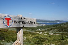 Signs are helpful and convenient, but no substitute for a map and compass. Raggsteindalen in Buskerud.
- It is easy to get lost at ridiculously short distances in unfamiliar terrain. Take a careful look even if you are going only for a minute. Dense forest, fog and open plateaus with no clear landmarks are the most difficult.
- Always take a map and compass with you when leaving the immediate vicinity of your camp (electronics is no substitute, only a supplement – instead of checking battery status you should create a good mental map). Learn to use a compass for navigation and learn to match your map with the terrain.
- If you do get lost, admit it and stop immediately. A few minutes of good rest is surprisingly effective at making you think clearly again. Lines in the terrain can be used to find way back, for instance rivers (rivers can lead you to settlements or to lakes and other points that can be identified on the map), power lines and slopes. But beware of slopes making you change direction and leading you only to a local depression, rivers leading you to hard-to-walk wet terrain, etc. Check the map for what lines are usable.
- Bugs و الحيوانات
- Mosquitoes and black flies are a nuisance in June and July, especially in Lapland and Finnmark. They do not carry diseases, but repellents, long sleeves, long pants and perhaps a mosquito hat in the worst areas are recommended. Avoid keeping doors and windows open in the evening.
- القراد can carry Lyme disease and TBE in some areas (especially south Norway to south-west Finland). The risk is small for a casual visitor, but you may want to take precautions.
- There are big predators like bears, wolves, lynxes and wolverines in the Nordic countries, but they are generally no threat to people, as they will flee in most circumstances once they smell or hear humans. Back out if you encounter bear cubs, as their mother will protect them. Also musk oxen, elks and boars can be dangerous if you go too close.
- If you are hiking in the hunting season (the autumn), in areas where hunting is allowed, you should wear some orange or red clothing. Ask for local advice about whether any areas should be avoided. Hunting season varies by species. Moose hunting is common in the forest areas of Sweden, Finland, East Norway and Trøndelag. Red deer hunting is common in West Norway. Reindeer hunting occurs mostly in the barren mountains.
- Be careful in sun
- Clear Nordic air, high altitude and snow patches can multiply the effect of the sun, which hardly sets during the Nordic summer. Snow blindness is a serious risk, so bring UV-resistant sunglasses, and preferably mountain goggles. Bring sun cream or sun block (sun protection factor). Light can be strong in the highlands even if the sun is not visible.
- Glaciers
 Do not go on your own. جوستيدالسبرين glacier.
- Glaciers are one of the most dangerous places for visitors to the Norwegian outdoors. Never underestimate the power of the glacier. Observe warning signs. Never approach the front of the glacier. A glacier is not a stable piece of ice, it is constantly moving and huge chunks regularly fall off. Snowbridges can obscure crevasses.
- The sun's rays get reflected from the white snow, so it necessary to use sunscreen and sunglasses to protect your skin and eyes. Bring warm clothes for tours on the glacier.
- يفعل ليس enter a glacier without proper equipment and a skilled local guide.


Rules of mountain conduct
Norway's trekking association has compiled a set of rules or guidelines for sensible hiking, "fjellvettreglene":
- Don't go for a long hike without training.
- Tell where you are going.
- Respect weather and forecast
- Be prepared for storm and cold weather even on shorter hikes. Bring a rucksack with the kind of gear needed.
- Listen to experienced hikers.
- Dont hike alone.
- Use map and compass
- Turn back in time, it is nothing to be ashamed of.
- Don't waste your energy. Dig into snow if necessary.
Volcanic eruption

Out of the Nordic countries, Iceland is the only one with active volcanoes.
As a precautionary mesure carry a cell phone and a battery powered radio, and heed to warnings from the Icelandic civil protection about hazardous areas. Listen to either the radio station Rás 1 or Bylgjan. Rás 1 is on the LW frequencies 189 kHz and 207 kHz. For the FM frequencies see the frequency map of Ras و frequencies of Bylgjan. Pay attention to any SMS messages you get, as the Icelandic civil protection does send out SMS messages in Icelandic and English to phones in hazardous areas.
Should an eruption occur the ash can spread throughout the whole country depending on the wind direction. Eruptions increase the chance of lightnings and a glacial eruption will generate n flood in rivers with sources at the melting glacier.
Regardless of where you are in the country during an eruption, consider the wind direction and consider whether the wind can spread the ash to you. As an alternative you can use the mobile website of the Icelandic met office. If so, walk high up in the landscape to avoid poisonous gases, cover your nostrils and mouth with a cloth. Should the ash get thick or if you have an asthma, go into the next day or wilderness hut, close windows on the side that the wind blows at, close the chimney and stay there until the wind direction changes.
Should you be in close proximity of an eruption walk opposite to the wind direction to get out of the area. If you have concerns that you cannot abandon a hazardous area in time, do not hesitate to call the emergency number 112.
احترام

Many people you meet on remote trails are there to be with nature only. They might not be interested in socializing and will probably frown upon noisy behaviour. It is common, though, to stop and exchange a few words, e.g. about the terrain ahead, and at least some kind of greeting is usually expected when you meet people on (or off) the trail. Some might of course be interested in where you come from. People are often less reserved with strangers when they are in the wilderness.
Smoking is disliked by many and can be a serious hazard. In hot and dry periods a cigarette butt can cause a forest fire (even if "extinguished"), so just like with other litter, avoid leaving them in nature. Smoking indoors is mostly prohibited. Where locals smoke you might follow their example, but otherwise try to be a good example yourself.
Even if there is right of access, wilderness is often privately owned. In Norway only barren high mountains are public (government) property. Trails and bridges are usually maintained by volunteers (the trekking association for instance) or by landowners for the visitors' benefit. ضع في اعتبارك أنك ضيف على أرض خاصة بشخص ما. يمكن أن يكون هناك حيوانات رعي وطرائد كبيرة لا ينبغي إزعاجها. لا تترك القمامة خلفك. يزداد شعبية بين الزوار لبناء أحجار حجرية في البرية ، على طول الشواطئ الصخرية والممرات الجبلية. تستخدم الأحجار الحجرية لتحديد المسارات ويمكن في الواقع أن تكون مضللة للمتنزهين. غالبًا ما يختار الزائرون الذين يبنون الأحجار الحجارة من الأسوار الحجرية ، وبعضها في الواقع تراث ثقافي أو قيد الاستخدام. من غير القانوني تغيير الطبيعة مثل هذا ، حتى لو كان ذلك باستخدام صخرة بسيطة.
تنطبق اعتبارات مماثلة على الأراضي العامة. معظم منطقة لابلاند مملوكة للحكومة نظرًا لأن الصامي لم يكن لديهم نفس فكرة الملكية. يعتمد السكان على البرية كما لو كانوا يمتلكون الأرض. وحيثما يتم الحفاظ على التسهيلات من قبل أموال دافعي الضرائب ، فإنها تكون نتيجة لإرادة مشتركة ، والتي يجب أن تحظى بقدر لا يقل عن التبرعات الخاصة.
أسماء الأماكن والكلمات المفيدة
نظرًا لأن الأسماء الموجودة على الخرائط والعلامات تشير عادةً إلى التضاريس ، فقد يكون فهم بعض كلمات المناظر الطبيعية مفيدًا. إذا كانت لديك إمكانية دراسة الخرائط واسعة النطاق مسبقًا ، فقد ترغب في التحقق من معنى البادئات واللاحقات الأكثر شيوعًا ، ولكن بعضها مدرج هنا. غالبًا ما يخبرون أشياء غير واضحة من الخريطة عن ميزة التضاريس أو يقدمون تلميحات حول تاريخ المنطقة.
عادةً ما تكون أسماء الأماكن في منطقة سامي من أصل سامي ، وأيضًا عندما لا يكون ذلك واضحًا. على سبيل المثال Lemmenjoki هو في الأصل "نهر دافئ" (من Sami: leammi ؛ الفنلندية: lämmin) ، وليس "نهر الحب" (بالفنلندية: lempi ، lemmen). غالبًا ما يُطلق على ميزات التضاريس في المنطقة كلمة سامي (على سبيل المثال "jåkk" ، جوهكا، بدلاً من الكلمات السويدية للتدفقات).
اللغات المستخدمة تستخدم الأسماء المركبة. يتم إنشاء الأسماء عادةً عن طريق الكلمات المركبة ، حيث يشير الجزء الأخير إلى الميزة الأفقية. على سبيل المثال جوستيدالسبرين هو اسم تم إنشاؤه من جوستيدال (وادي جوست) و بري (نهر جليدي) ، بمعنى آخر ، النهر الجليدي في جوستيدال. غالبًا ما تكون الكلمات بصيغة الجمع و / أو الجمع ، مما يؤدي إلى تعديل بسيط للكلمات ، في الفنلندية والسامية ليس دائمًا بشكل طفيف.
بالإضافة إلى ذلك ، تظهر المقالة التعريفية ("the") باللغتين النرويجية والسويدية كلاحقة ، مدمجة في الكلمة ، لذلك برين يعني الجبل الجليدي.
هناك عدة لغات سامية مختلفة وقد تم توحيد قواعد الإملاء الخاصة بهم قبل بضعة عقود فقط ، مما يعني وجود اختلافات إملائية أيضًا بشكل مستقل عن اللغات المستخدمة.
الحروف السويدية ä و ö مكتوبة æ و ö بالأيسلندية ، æ و ø بالنرويجية ؛ å مكتوبة باللغة الفنلندية ومعظم لغات سامي. غالبًا ما تُنطق السويدية ä بالقرب من e ، وتُكتب e باللغة النرويجية في العديد من تلك الحالات. يساعد التعرف على هذه الاختلافات وغيرها من الاختلافات المنهجية إلى حد ما في التهجئة أو النطق على فهم كلمة تعرفها من لغة أخرى ، مثل joki / jåkk / jåkkå / johka في مناطق سامي (هجاء الفنلندية والسويدية والسامية).
السويدية والنرويجية

- كارت / كارتا
- خريطة
- fjell ، fjäll
- الجبل ، القمة ، القمة (تشير إلى المناظر الطبيعية الممتدة فوق خط الشجرة ، وقد تشير إلى قمة معينة أو إلى الجبال بشكل عام)
- فيدي
- هضبة عالية ومفتوحة (فوق خط الشجرة)
- إنسجو ، فان ، فاتن ، سيو
- بحيرة ، بركة
- tjern ، tjärn
- بركة ، بحيرة صغيرة ، تارن
- skog
- الغابة ، الغابة
- مير ، كار
- مستنقع ، مستنقع
.jpg/220px-Besseggen_Hike,_Norway_(14673663307).jpg)
- اور تالوسكون
- حصاة ، ودائع الكاحل
- bre / glaciär ، fonn ، skavl
- جليدية ، جليد ثلجي
- دال
- الوادي
- juv ، kløft / klyfta ، رافين
- الخانق ، الوادي ، الوادي
- elv، bekk / älv، å، bäck
- نهر ، تيار ، جدول
- إخوانه / برو ، سوماربرو ، هيلارسبرو
- جسر ، جسر سحب في الشتاء ، جسر طوال العام
- فاد
- معقل
- ستوجا / ستو ، هايتي
- الكوخ ، المقصورة
- förfallen
- متحللة
- snaufjell / kalfjäll
- جبال قاحلة
- tregrense / trädgränsen
- خط الشجرة
- skyddsområde
- منطقة محمية
- الأمراض المنقولة جنسيا / ستيج
- المسار ، درب
- ruskmärkning
- علامات على شكل فروع في الثلج
- øy / ö ، هولمي ، سكار
- جزيرة ، جزيرة
- foss / fors ، vattenfall
- شلال ، منحدرات
ايسلندي

- كورت
- خريطة
- سقط ، فجال
- جبل
- هيتشي
- هضبة مفتوحة عالية
- فاتن ، تيورن
- بحيرة ، بركة
- موري
- مستنقع ، مستنقع
- فيورور
- المضيق البحري ، الخليج
- jökull
- الجليدية
- دالور
- الوادي
- gjá ، gljúfur
- الخانق ، الوادي ، الوادي
- أ
- نهر
- فوس
- شلال
- eyja ، سكر
- جزيرة ، جزيرة
الفنلندية والسامية
- كارتا
- خريطة
- vuori ، tunturi / tuodtar ، vaara / várri (várre ، várrie ، vaerie ، vare)
- جبل؛ vuori هي الكلمة العامة في الفنلندية ، لا تتجاوز tunturi و vaara do على التوالي خط الشجرة - ولكن várri في سامي هي الكلمة العامة للتل أو الجبل (غالبًا ما تكون حول المنحدرات الكبيرة) ، وغالبًا ما يتم ترجمتها إلى vaara ؛ يتم استخدام tunturi / duottarmailbmi أيضًا حول كل المنطقة فوق خط الشجرة
- كايسة / غييسة ؛ كيرو / تسيارو ؛ أويفي. كيلاس / جيلاس ، كايتا / سكيدي ؛ روفا / رواففي
- الجبال بأشكال مختلفة: ذروة عالية مغطاة بالثلوج ؛ جبل على شكل كومة فوق خط الشجرة ؛ جبل مستدير فوق خط الشجرة ("الرأس") ؛ ريدج. تل صخري مع غابات متفرقة
- čohkka (tjåhkkå، tjåhkka، tjahkke، tjåkkå)
- القمة ، القمة
- ماكي ، كاليو ، هارجو / بولدسا
- هيل ، (تل) سوليد روك ، إيسكر
- سكيدي ، سيلكا / سيلجي
- سلسلة من التلال ، منطقة مستجمعات المياه (selkä أيضًا امتداد للبحر أو بحيرة كبيرة) / سلسلة من التلال مع خشب البتولا ، بجانب جبل
- باهتا / باهته
- منحدر التل المرتفع والمنحدر
- järvi / jávri (jávrre ، avrre ، havrre ، jávrrie ، jaevrie ، jävri ، jäu'rr ، jauri ، jaure ، jaur)
- بحيرة ، بركة
- vesi
- المياه ، وغالبًا ما تعني "بحيرة" في الأسماء
- لايد ، كالتيو / جالدو
- ربيع
- لامبي
- بركة ، بحيرة صغيرة ، تارن
- لاهتي / لوكتا (لوكتا ، لوكتا)
- خليج
- niemi / njárga (njárgga ، njarka)
- رداء

- suo ، rahka ، räme ، aapa / aaphe ، jänkä / jeäggi ، vuoma / vuobme
- مستنقع مستنقع سو هي الكلمة العامة ، والبعض الآخر أنواع مختلفة ؛ vuoma / وادي vuobmi أيضا
- بالسا
- تل الصقيع (في مستنقع أو مستنقع)
- jäätikkö
- جليدية ، جليد ثلجي
- لاكسو
- الوادي
- rotko، kuru / autsi، ävdzi، gorsa
- الخانق ، الوادي ، الوادي
- joki / johka (jåhkå، juhka، johke، jåkkå، jåkk)، eno / eädnu، puro، oja / ája،
- نهر ، تيار ، جدول ؛ joki / johka هي الكلمة العامة ، eno كبير جدًا ، puro صغير ، oja صغير
- كالامو
- معقل
- ميتسا. kuusikko و männikkö و koivikko إلخ.
- الغابات والأخشاب؛ الأخشاب الأخيرة من أنواع مختلفة من الأشجار (kuusi = شجرة التنوب ، mänty = الصنوبر ، koivu = البتولا)
- رجا
- الحدود ، الحد
- بوراجا
- خط الشجرة
- rajavyöhyke
- منطقة الحدود
- kuusimetsän راجا
- الحد (الشمالي) لغابات التنوب ("kuusi")
- بولكو ، ريتي
- المسار ، درب
- موكي ، بيرتي ، توبا ؛ كامي / جام
- كوخ كوخ كوخ العشب
- سييدا
- قرية أو مجتمع سامي

- سيتا / سيدي
- الروح ، الشيء المقدس
- ساري ، لوتو
- جزيرة ، جزيرة
- koski، niva، kurkkio، kortsi / gorzze
- منحدرات ، الأخيرة منها شديدة الانحدار وصخرية
- سوفانتو ، سافو
- الماء الراكد (تحت منحدرات)
- كونجاس
- منحدرات شديدة الانحدار ، شلال طفيف
- (vesi) عفوي
- شلال
- latu (pl. ladut) / láhtu
- مسار التزلج
الاتصال

بريد الحلزون
قد تكون هناك صناديق بريد وطوابع متاحة في المتاجر والشركات السياحية. بدلاً من poste restante ، قد ترغب في استخدام ملف عنوان ج / س. اسأل عن الممارسات المحلية.
الهواتف
توجد تغطية جيدة للهاتف المحمول بشكل عام في بلدان الشمال ، ولكن ليس بالضرورة في الأماكن التي تحتاجها. تحتوي بعض الأكواخ البرية على هواتف لإجراء مكالمات الطوارئ (لم تعد موجودة في فنلندا ؛ فهي شائعة في السويد ، ويجب استخدامها أيضًا للتحدث عن تأخرك وللحصول على المشورة إذا لزم الأمر ، وليس فقط في حالات الطوارئ).
في المناطق الجبلية غالبًا لا توجد إشارة في الوديان. قد لا تكون هناك إشارة في المناطق النائية باستثناء قمم الهبوط. قد ترغب في اختبار خدمات الإنترنت المهمة باستخدام اتصال منخفض السرعة (حتى 9600 بت / ثانية) مسبقًا. هناك خدمات الطقس SMS. كان الجيل الثالث متاحًا فقط بالقرب من المدن الكبيرة والمنتجعات السياحية الهامة وعلى طول بعض الطرق الرئيسية ، ولكنه متاح الآن في فنلندا حتى في كثير من المناطق البرية.
تختلف التغطية من مزود إلى آخر. إذا كان لديك أكثر من هاتف واحد (بطاقة SIM) في الشركة ، فقد ترغب في أن يكون لديك مزودون مختلفون. لاحظ أن أفضل إشارة قد تكون من دولة مجاورة ، وبالتالي قد تضطر إلى الدفع مقابل المكالمات الدولية حتى باستخدام بطاقة SIM محلية ، إذا سمحت للهاتف باختيار المزود.
عندما تكون الإشارة سيئة ، لا تحاول إجراء مكالمات ، ولكن استخدم الرسائل القصيرة: تحتاج الرسائل إلى إشارة فقط لبضع ثوان ، وبالتالي ستكون أكثر موثوقية وستستهلك طاقة أقل.
حافظ على جفاف هاتفك. تذكر أنه يتم استخدام البطاريات بشكل أسرع في حالة وجود إشارة سيئة. ابق هاتفك مغلقًا معظم الوقت. لا تتوفر الكهرباء عادة في المناطق النائية ، وليس بالضرورة في البيوت والمنازل.
مكالمات الطوارئ
ال رقم الطوارئ 112 يعمل في جميع دول الشمال. قد تكون هناك أرقام خاصة لبعض حالات الطوارئ ، ولكن ☏112 يمكن التعامل معها جميعًا. المكالمات إلى 112 مجانية وتعمل دون أي اعتبار للأقفال مع معظم الهواتف. ما عليك سوى كتابة الرقم أو استخدام زر الطوارئ (في بعض الهواتف الذكية). في الواقع ، قد ترغب في بعض الحالات في إزالة بطاقة SIM للتأكد من أن الهاتف يستخدم أفضل اتصال متاح. للأسف ، يوقف الهاتف السويدي 112 المكالمات التي لا تحتوي على بطاقة SIM حتى تضغط على "5". في فنلندا ، سيتم تعليق مثل هذه المكالمات لمدة نصف دقيقة تقريبًا قبل الرد عليها.
ل هواتف الأقمار الصناعية رقم خدمة الطوارئ هو ☏ 46 63-107-112 (السويد)، 358 9 2355-0545 (فنلندا) ، 354 809-0112 (تحقق أيسلندا!). تقع سواتل Inmarsat-14 على ارتفاع 15 درجة فقط فوق الأفق الجنوبي وبالتالي يتم حظرها بسهولة بواسطة التضاريس المرتفعة أو العوائق الأخرى إيريديوم ليس لديه هذه المشكلة.
لا تتردد في إخبار خدمة الطوارئ عن أي مشاكل قد تؤدي إلى حالة طارئة. تأكد من الاتصال بهم أيضًا لإخبارهم أنك بأمان ، وبالمثل عندما تتأخر وقد يتصل شخص ما لبدء عملية الإنقاذ. النفقات هي بسهولة خمسة أرقام - باليورو في الساعة (تدفع عادة من أموال دافعي الضرائب ، لكنك لا تريد إساءة استخدام النظام).
من الأفضل تحديد الموقع على أنه إحداثيات ETRS89 / WGS84 (تحقق مسبقًا مما إذا كان هذا هو ما يتم استخدامه على خريطتك). يمكن أيضًا استخدام الاتجاه والمسافة من موقع معروف أو أي نظام إحداثي على خريطتك. أخبر بعض الأسماء بالقرب من المنصب أيضًا ، لتجنب الأخطاء. لاحظ أن كلاً من أنظمة 360 درجة وعدة مل (60 أو 63 أو 64 هيكتوميل للدائرة) تُستخدم على البوصلات وأن بعض الأسماء ، مثل Ailigas ("السقوط المقدس") غامضة. في فنلندا ، قد تطلب خدمة الطوارئ البلدية والعنوان (وهي تخدم مناطق شاسعة) ، لكنها ستكون معقولة عندما تخبرهم أنك لا تعرف.
ملاحو الأقمار الصناعية (نظام تحديد المواقع العالمي وما إلى ذلك ؛ غالبًا ما يتم تضمينه في الهواتف الذكية ، وأحيانًا في الكاميرات) يستخدم قدرًا كبيرًا من الطاقة ، لذلك من الأفضل إبعاده في معظم الأوقات ، ولكن يمكنه غالبًا تقديم إحداثيات دقيقة في حالات الطوارئ يستغرق الأمر بعض الوقت بالنسبة لهم للعثور على الأقمار الصناعية وقد يعطون إحداثيات خاطئة حتى ذلك الحين. تأكد من أنك تفهم إعداداتهم وسلوكهم.
التأقلم
المخلفات
غالبًا ما توجد صناديق قمامة في الأكواخ والملاجئ ومواقع النار. خاصة في حالة عدم وجود طريق ، يجب تجنب استخدام هذه الطرق ، وحزمها بدلاً من ذلك. يعني تفريغ حاويات النفايات في المناطق النائية حركة مرور غير ضرورية ومكلفة. لا ينبغي وضع بقايا الطعام وما شابه ذلك في سلة المهملات إلا إذا كنت تعلم أنه سيتم إفراغها قريبًا. يمكن وضع كميات صغيرة من النفايات العضوية ، مثل بقايا الطعام ، في مراحيض الحفرة (ومراحيض التسميد الأكثر تقدمًا). هناك سماد منفصل في بعض المواقع. في نقاط إعادة التدوير ، يمكن العناية بالورق والمعادن والزجاج بشكل منفصل. يمكن أيضًا دفن النفايات العضوية خارج الممرات ، إذا لزم الأمر ، ولكن بشكل خاص في الخث وفوق خط الأشجار ، قد يستغرق التحلل سنوات عديدة. يمكن حرق الورق النقي في نيران المخيمات والمواقد ، ولكن يجب تغليف الورق المغطى بالمعدن أو البلاستيك. لا تترك نفايات للآخرين ليحرقوها.
مراحيض
على طول الممرات توجد مراحيض في الأكواخ وغالبًا في الملاجئ ومواقع النار ، وعادة ما تكون كافية لتلبية احتياجاتك الأكبر إذا كنت تستخدم هذه الخدمات. عادة ما تكون مراحيض جافة: مرحاض به فتحة في المقعد ودلو به خث أو نشارة خشب أو ما شابه ذلك لتغطية البراز. قد تضطر إلى استخدام ورق التواليت الخاص بك. عادة ما يكون غسل يديك هو مشكلتك الخاصة (لا تفعل ذلك في المنبع من حيث يأخذ الناس مياه الشرب الخاصة بهم ، ولا بالقرب من دلو مياه الشرب). خارج الممرات وبين الأكواخ ، نصيحة تخييم لا يترك أثرا يمكن اتباعها.
غسل
هناك الكثير من الجداول والبحيرات ، أو شواطئ البحر ، في معظم أنحاء البلاد ، لذلك نادرًا ما يكون العثور على الماء لغسل نفسك مشكلة - ولكن بشكل خاص في الشمال ، باستثناء شهري يوليو وأغسطس ، يكون الجو باردًا في الغالب. فقط اعتمد نفسك على ذلك أو استخدم حمامات البخار. لغسل يديك ، يمكن تسخين كميات قليلة من الماء على موقدك ، لكن الماء البارد غالبًا ما يكون كافياً. في العديد من الأماكن ، يجب أن تتجنب التراب أو الصابون في البحيرة أو النهر ، والقيام بمعظم الغسيل على الأرض. مياه البحر ليست مالحة جدا في بحر البلطيق ونادرا ما تكون في المضايق البحرية.
لا تتوفر الدش بشكل عام في الأكواخ البرية ، ولكن يمكن أن تكون متاحة في بعض الأكواخ وفي المخيمات الحقيقية إذا صادفتها. بدلاً من ذلك ، استخدم حمامات البخار الموجودة في العديد من الأكواخ والكبائن. بالنسبة إلى ساونا الإجراء ، راجع هذه المقالة (عندما لا تكون في فنلندا ، تحقق مما إذا كان السلوك المتوقع مختلفًا) ، ولكن الغسيل بشكل صحيح يكون عادةً عن طريق خلط الماء الساخن والبارد في حوض غسيل واستخدام ذلك. امزج مجموعة جديدة أو اثنتين للشطف.